place

North Tuddenham

Breckland DistrictCivil parishes in NorfolkNorfolk geography stubsVillages in Norfolk
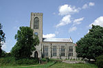
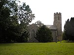
St Mary the Virgin, North Tuddenham, Norfolk geograph.org.uk 308315

North Tuddenham is a civil parish in the English county of Norfolk, North Tuddenham is 3 miles (4.8 km) east of East Dereham, and is close to the A47 road. The parish church is dedicated to St Mary.The villages name means 'Tuda's homestead/village'. It covers an area of 9.41 km2 (3.63 sq mi) and had a population of 305 in 121 households at the 2001 census, increasing to a population of 335 in 138 households at the 2011 Census. For the purposes of local government, it falls within the Upper Wensum Ward of Breckland District Council and the Elmham and Mattishall Division of Norfolk County Council. RAF Tuddenham is nearby: in 1944, a USAF B24 bomber plane on a training mission crashed at North Tuddenham, killing the eight crew members. A memorial plaque is in St Mary's church. The incident is also commemorated in a village flag, designed by a local school student, Esme Okan, in 2021.

Excerpt from the Wikipedia article North Tuddenham (License: CC BY-SA 3.0, Authors, Images).

North Tuddenham
Mill Road, Breckland District North Tuddenham

Geographical coordinates (GPS) Address Nearby Places
placeShow on map

Wikipedia: North TuddenhamContinue reading on Wikipedia

Geographical coordinates (GPS)

Latitude Longitude
N 52.6863 ° E 1.0148 °
placeShow on map

Address

Mill Road

Mill Road
NR20 3DB Breckland District, North Tuddenham
England, United Kingdom
mapOpen on Google Maps

St Mary the Virgin, North Tuddenham, Norfolk geograph.org.uk 308315
Share experience

Nearby Places

List of Sites of Special Scientific Interest in Norfolk

In England, Sites of Special Scientific Interest (SSSIs) are designated by Natural England, which is responsible for protecting England's natural environment. Designation as an SSSI gives legal protection to the most important wildlife and geological sites. As of May 2020 there are 163 SSSIs in Norfolk, out of which 123 are biological, 25 are geological and 15 are both biological and geological. Sixty-one sites are Special Areas of Conservation, forty-four are Special Protection Areas, thirty-two are Ramsar sites, forty are Geological Conservation Review sites, thirty-five are Nature Conservation Review sites, eighteen are national nature reserves, ten are local nature reserves, twenty-eight are in Areas of Outstanding Natural Beauty, one is on the Register of Historic Parks and Gardens and three contain scheduled monuments. Twenty-two sites are managed by the Norfolk Wildlife Trust, one by the Suffolk Wildlife Trust, three by the National Trust, one by the Royal Society for the Protection of Birds and one by the Wildfowl & Wetlands Trust. Norfolk is a county in East Anglia. It has an area of 2,074 square miles (5,370 square kilometres) and a population as of mid-2017 of 898,400. The top level of local government is Norfolk County Council with seven second tier councils: Breckland District Council, Broadland District Council, Great Yarmouth Borough Council, King's Lynn and West Norfolk Borough Council, North Norfolk District Council, Norwich City Council and South Norfolk District Council. The county is bounded by Cambridgeshire, Suffolk, Lincolnshire and the North Sea.