Mary Rose

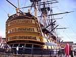
The Mary Rose was a carrack in the English Tudor navy of King Henry VIII. She was launched in 1511 and served for 33 years in several wars against France, Scotland, and Brittany. After being substantially rebuilt in 1536, she saw her last action on 19 July 1545. She led the attack on the galleys of a French invasion fleet, but sank in the Solent, the strait north of the Isle of Wight. The wreck of the Mary Rose was located in 1971 and was raised on 11 October 1982 by the Mary Rose Trust in one of the most complex and expensive maritime salvage projects in history. The surviving section of the ship and thousands of recovered artefacts are of great value as a Tudor period time capsule. The excavation and raising of the Mary Rose was a milestone in the field of maritime archaeology, comparable in complexity and cost to the raising of the 17th-century Swedish warship Vasa in 1961. The Mary Rose site is designated under the Protection of Wrecks Act 1973 by statutory instrument 1974/55. The wreck is a Protected Wreck managed by Historic England. The finds include weapons, sailing equipment, naval supplies, and a wide array of objects used by the crew. Many of the artefacts are unique to the Mary Rose and have provided insights into topics ranging from naval warfare to the history of musical instruments. The remains of the hull have been on display at the Portsmouth Historic Dockyard since the mid-1980s while undergoing restoration. An extensive collection of well-preserved artefacts is on display at the Mary Rose Museum, built to display the remains of the ship and its artefacts. Mary Rose was one of the largest ships in the English navy through more than three decades of intermittent war, and she was one of the earliest examples of a purpose-built sailing warship. She was armed with new types of heavy guns that could fire through the recently invented gun-ports. She was substantially rebuilt in 1536 and was also one of the earliest ships that could fire a broadside, although the line of battle tactics had not yet been developed. Several theories have sought to explain the demise of the Mary Rose, based on historical records, knowledge of 16th-century shipbuilding, and modern experiments. The precise cause of her sinking is subject to conflicting testimonies and a lack of conclusive evidence.
Excerpt from the Wikipedia article Mary Rose (License: CC BY-SA 3.0, Authors, Images).Mary Rose
College road, Portsmouth Portsea
Geographical coordinates (GPS) Address Nearby Places Show on map
Geographical coordinates (GPS)
| Latitude | Longitude |
|---|---|
| N 50.799722222222 ° | E -1.1066666666667 ° |
Address
Boathouse № 6
College road 1/23
PO1 3LX Portsmouth, Portsea
England, United Kingdom
Open on Google Maps


