Monks Horton
Civil parishes in KentKent geography stubs

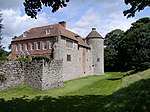
Monks Horton is a small civil parish in the Folkestone and Hythe district of Kent, England. It is located 3 miles (5 km) north of Hythe. Within the civil parish are the hamlets of Horton and Broad Street. The parish is governed by a parish meeting, rather than a parish council, because of its small size. The name comes from there having been a medieval priory built here. The population of the parish in 2001 was 95.
Excerpt from the Wikipedia article Monks Horton (License: CC BY-SA 3.0, Authors, Images).Monks Horton
Folkestone and Hythe District
Geographical coordinates (GPS) Address Nearby Places Show on map
Geographical coordinates (GPS)
| Latitude | Longitude |
|---|---|
| N 51.120277777778 ° | E 1.0208333333333 ° |
Address
TN25 6DY Folkestone and Hythe District
England, United Kingdom
Open on Google Maps


