Sefton, New South Wales
City of Canterbury-BankstownMuslim enclavesSuburbs of SydneyUse Australian English from August 2019

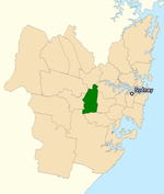
Sefton is a suburb of the City of Canterbury-Bankstown local government area. It is located 23 kilometres west of the Sydney central business district, in New South Wales, Australia. Part of the Western Sydney region, it shares the 2162 postcode with the neighbouring suburb of Chester Hill.
Excerpt from the Wikipedia article Sefton, New South Wales (License: CC BY-SA 3.0, Authors, Images).Sefton, New South Wales
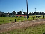
View Street, Sydney Sefton
Geographical coordinates (GPS) Address Nearby Places Show on map
Geographical coordinates (GPS)
| Latitude | Longitude |
|---|---|
| N -33.888333333333 ° | E 151.00722222222 ° |
Address
View Street
View Street
2162 Sydney, Sefton
New South Wales, Australia
Open on Google Maps


