Negro Mountain
1756 in PennsylvaniaAfrican-American-related controversiesAfrican-American history in AppalachiaAfrican-American history of MarylandAfrican-American history of Pennsylvania ... and 11 more
African–Native American relationsAllegheny MountainsBattles of the French and Indian WarGeographical naming disputesLandforms of Garrett County, MarylandLandforms of Somerset County, PennsylvaniaLaurel HighlandsNative American history of MarylandNative American history of PennsylvaniaRidges of MarylandRidges of Pennsylvania

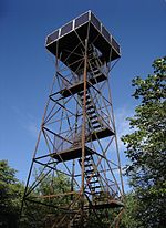
Negro Mountain is a long ridge of the Allegheny Mountains in the eastern United States, stretching 30-mile (48 km) from Deep Creek Lake in Maryland north to the Casselman River in Pennsylvania. The summit, Mount Davis, is the highest point (3,213 feet) in Pennsylvania. Negro Mountain is flanked by Laurel Hill to the west and Allegheny Mountain to the east.
Excerpt from the Wikipedia article Negro Mountain (License: CC BY-SA 3.0, Authors, Images).Negro Mountain
Christner Road, Elk Lick Township
Geographical coordinates (GPS) Address Nearby Places Show on map
Geographical coordinates (GPS)
| Latitude | Longitude |
|---|---|
| N 39.786111111111 ° | E -79.175 ° |
Address
Mount Davis Natural Area
Christner Road
15540 Elk Lick Township
Pennsylvania, United States
Open on Google Maps


