Fort Hill, Pennsylvania
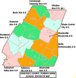
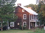
Fort Hill is an unincorporated community in Somerset County, Pennsylvania, United States. The community is located along the Casselman River, 4.6 miles (7.4 km) east-northeast of Confluence. Fort Hill has a post office, with ZIP code 15540, which opened on December 23, 1885.Fort Hill was the location of a Monongahela Native American settlement, which a 1939-1940 WPA excavation directed by Edgar Augustine dated to circa 1275-1300.Fort Hill sits along the old Baltimore and Ohio Railroad main line; a view of the natural landmark appeared in a collection of photographs from along the B&O's lines that was published in book form in 1872 and digitized by the DeGolyer Library, Southern Methodist University.Fort Hill has a trail access area for the Great Allegheny Passage rail trail. This is the only trail access area with parking between Markleton to the northeast and Harnedsville to the southwest.
Excerpt from the Wikipedia article Fort Hill, Pennsylvania (License: CC BY-SA 3.0, Authors).Fort Hill, Pennsylvania
Fort Hill Road, Upper Turkeyfoot Township
Geographical coordinates (GPS) Address Nearby Places Show on map
Geographical coordinates (GPS)
| Latitude | Longitude |
|---|---|
| N 39.830277777778 ° | E -79.2725 ° |
Address
Fort Hill Road 488
15540 Upper Turkeyfoot Township
Pennsylvania, United States
Open on Google Maps


