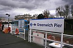
A1206 road (Great Britain)
Ring roads in LondonTransport in the London Borough of Tower HamletsUse British English from February 2018

The A1206, also known as the Isle of Dogs Distributor Road, is a crescent-shaped ring road around the Isle of Dogs, in the East End of London. It is made up of Westferry Road, Manchester Road and Prestons Road and is the main road through the area, connecting parts of the London Docklands.
Excerpt from the Wikipedia article A1206 road (Great Britain) (License: CC BY-SA 3.0, Authors, Images).A1206 road (Great Britain)
Ferry Street, London Isle of Dogs
Geographical coordinates (GPS) Address Nearby Places Show on map
Geographical coordinates (GPS)
| Latitude | Longitude |
|---|---|
| N 51.487222222222 ° | E -0.013333333333333 ° |
Address
Ferry Street
Ferry Street
E14 3QL London, Isle of Dogs
England, United Kingdom
Open on Google Maps


