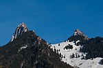
Dent de Brenleire
Canton of Fribourg geography stubsMountains of SwitzerlandMountains of the AlpsMountains of the canton of FribourgPages with French IPA ... and 1 more
Two-thousanders of Switzerland

The Dent de Brenleire (French pronunciation: [dɑ̃ d(ə) bʁɑ̃lɛːʁ]; lit. 'Tooth of Branleire') is a mountain of the Fribourg Alps, located south of Charmey in the Swiss canton of Fribourg. It has an elevation of 2,354 metres above sea level and is amongst the highest summits in the canton of Fribourg, after the Vanil Noir, the Vanil de l'Ecri and the Pointe de Paray. It is also the highest mountain entirely within the canton. The summit of the Dent de Brenleire is accessible by a trail running on the east side of the mountain, from the Gros Mont.
Excerpt from the Wikipedia article Dent de Brenleire (License: CC BY-SA 3.0, Authors, Images).Dent de Brenleire
Val-de-Charmey
Geographical coordinates (GPS) Address Nearby Places Show on map
Geographical coordinates (GPS)
| Latitude | Longitude |
|---|---|
| N 46.550833333333 ° | E 7.1747777777778 ° |
Address
Les Morteys de Folliéran
1637 Val-de-Charmey (Charmey)
Fribourg, Switzerland
Open on Google Maps


