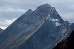
Dent de Savigny
Canton of Fribourg geography stubsFribourg–Vaud borderMountains of SwitzerlandMountains of the AlpsMountains of the canton of Fribourg ... and 3 more
Mountains of the canton of VaudSwitzerland mountain stubsVaud geography stubs

The Dent de Savigny is a mountain of the Bernese Alps, located on the border between the Swiss cantons of Vaud and Fribourg. With an elevation of 2,252 metres above sea level, it one of the highest mountains in the canton of Fribourg. The closest localities are Jaun (Fribourg) and Rougemont (Vaud).
Excerpt from the Wikipedia article Dent de Savigny (License: CC BY-SA 3.0, Authors, Images).Dent de Savigny
Geographical coordinates (GPS) Address Nearby Places Show on map
Geographical coordinates (GPS)
| Latitude | Longitude |
|---|---|
| N 46.549666666667 ° | E 7.2267777777778 ° |
Address
Les Fontaines
1659
Vaud, Switzerland
Open on Google Maps


