place

Dial Post

Horsham DistrictVillages in West Sussex
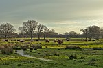
Worthing Road, Dial Post geograph.org.uk 149501

Dial Post is a village in the Horsham District of West Sussex, England. The civil parish, where the lowest level political meetings are held, is West Grinstead in the north-east - its biggest settlement is 2 miles (3.2 km) east at Partridge Green. It has a population of around 100 based on the average headcount per inhabited dwelling. In 2001 the population of the civil parish as a whole was 2,934

Excerpt from the Wikipedia article Dial Post (License: CC BY-SA 3.0, Authors, Images).

Dial Post
Worthing Road,

Geographical coordinates (GPS) Address Nearby Places
placeShow on map

Wikipedia: Dial PostContinue reading on Wikipedia

Geographical coordinates (GPS)

Latitude Longitude
N 50.96377 ° E -0.35651 °
placeShow on map

Address

Worthing Road
RH13 8NH
England, United Kingdom
mapOpen on Google Maps

Worthing Road, Dial Post geograph.org.uk 149501
Share experience

Nearby Places

Brightling Park
Brightling Park

Brightling Park (previously known as Rose Hill) is a country estate which lies in the parishes of Brightling and Dallington in the Rother district of East Sussex, England. It is now the home of Grissell Racing, who have operated a racehorse training facility there for more than 30 years.The 18th-century house is brick-built in two storeys with a nine window north front and stands in some 200ha (490 acres) of parkland. Additional wings added in 1810 were demolished in 1955. 18th-century grade II listed stables and a coach-house to the south-east of the house comprise a single long building. The house is approached by an avenue bounded by ha-has, to the side of which stands a grade II listed alcove or summerhouse. The parkland is Grade II listed whereas Brightling Park House itself is a Grade II* listed building.Associated with the estate are a number of follies and an observatory, all designed by architect Sir Robert Smirke for John "Mad Jack" Fuller in the early 1800s. The Alcove or Summerhouse stands to the west of the house within the park and is a semicircular alcove built of red brick with a four-centred archway entrance flanked by pairs of interlocking columns. Built in 1803, it is a Grade II listed building.The Temple, standing within the park 400m to the south-west of the house, is a small circular building consisting of a colonnade surmounted by a dome. It is a Grade II* listed building.The Obelisk, also known as Brightling Needle, stands some 500m outside the park's perimeter wall on top of Brightling Down and is a Grade II* listed building.The Observatory was built in 1818 on a high spot outside the park some 150m to the west. It is a T-shaped one storey building built of ashlar with slits for the telescopes. Now a private house, it is also a Grade II* listed building.