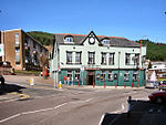
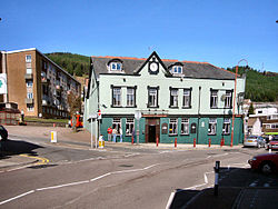
Penygraig
AC with 0 elementsCommunities in Rhondda Cynon TafRhondda ValleyUse British English from June 2013Villages in Rhondda Cynon Taf

Penygraig is a village and community in the Rhondda Valley in the county borough of Rhondda Cynon Taf, Wales. As a community Penygraig contains the neighbouring districts of Dinas, Edmondstown, Penrhiwfer and Williamstown. Penygraig is within the historic county boundaries of Glamorgan. The name Penygraig is Welsh for 'head of the rock'.
Excerpt from the Wikipedia article Penygraig (License: CC BY-SA 3.0, Authors, Images).Penygraig
Thomas Street,
Geographical coordinates (GPS) Address Nearby Places Show on map
Geographical coordinates (GPS)
| Latitude | Longitude |
|---|---|
| N 51.6133 ° | E -3.4528 ° |
Address
Thomas Street
Thomas Street
CF40 1EU , Penygraig
Wales, United Kingdom
Open on Google Maps


