place

Sandybottom, Virginia

Charles City County, Virginia geography stubsUnincorporated communities in Charles City County, VirginiaUnincorporated communities in VirginiaUse mdy dates from July 2023

Sandybottom is an unincorporated community in Charles City County, Virginia, United States.

Excerpt from the Wikipedia article Sandybottom, Virginia (License: CC BY-SA 3.0, Authors).

Sandybottom, Virginia
Sturgeon Point Road,

Geographical coordinates (GPS) Address Nearby Places
placeShow on map

Wikipedia: Sandybottom, VirginiaContinue reading on Wikipedia

Geographical coordinates (GPS)

Latitude Longitude
N 37.413333333333 ° E -77.044444444444 °
placeShow on map

Address

Sturgeon Point Road 4800
23140
Virginia, United States
mapOpen on Google Maps

Share experience

Nearby Places

Providence Forge, Virginia

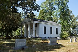
Providence Forge is an unincorporated community in New Kent County, Virginia, United States. It was one of the earliest settlements in the county (itself formed by 1654) and the site of a colonial iron forge that was destroyed by British General Banastre Tarleton during the American Revolutionary War. Nearby, the Chickahominy River separates New Kent from Charles City County. U.S. Route 60 and State Route 155 pass through Providence Forge. The Colonial Downs horse-racing facility is located nearby adjacent to the Providence Forge exit of Interstate 64. A station on the Chesapeake and Ohio Railway (C&O) was located at Providence Forge in 1881 during construction of the railroad's new Peninsula Subdivision, which was built primarily to facilitate transportation of West Virginia bituminous coal to the newly created city of Newport News. There, on the harbor of Hampton Roads, coal piers were built to load colliers for worldwide export shipment.The C&O's Peninsula Extension was good news for the farmers and merchants of the Virginia Peninsula, and they generally welcomed the railroad. Providence Forge was a stop for passengers until about 1931 and for freight until at least the late 1960s, according to the Chesapeake & Ohio Historical Society. The structure was dismantled sometime in 2006. The only similar structure, at Lee Hall, has been preserved and efforts were underway in 2008 to relocate it slightly away from the right-of-way and open it as a museum.Cedar Grove, Emmaus Baptist Church, Olivet Presbyterian Church, and Spring Hill are listed on the National Register of Historic Places.

Lott Cary Birth Site

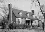
Lott Cary Birth Site, also known as the Lott Cary House, is a historic home located near Charles City, Charles City County, Virginia. The modest wooden frame plantation house was built in the late-18th century, and consists of a 1+1⁄2-story, three-bay, original main house, extended by the later addition of one-story wings. Little of the original fabric remains.There is a strong local oral tradition that the property was the birth site of Lott Cary (1780–1828), a slave held by planter John Bowry, who owned the house. After being hired out in Richmond, Virginia, Cary bought his freedom and that of his children. He had been promoted to supervise tobacco workers and also served as a shipping clerk. In the state capital he became a Baptist minister and lay physician, and learned to read and write. He emigrated to the new Colony of Liberia in Africa in 1821, where he helped develop it. He established the first church in Monrovia, and set up Christian schools for natives in the interior. He also served several months in 1828 as acting governor. At the time of Cary's birth in 1780, this house served as the residence of Cary's master John Bowry, whose plantation comprised more than 600 acres. Cary was most likely born in slave quarters near the house, but no dependencies remain on the property.This house and site was added to the National Register of Historic Places in 1980, in recognition of Cary's significance in American history.