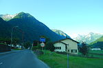
Kärpf
Canton of Glarus geography stubsMountains of SwitzerlandMountains of the AlpsMountains of the canton of GlarusSwitzerland mountain stubs ... and 1 more
Two-thousanders of Switzerland

The Kärpf (or Chärpf) is a mountain in the Glarus Alps, at an elevation of 2,794 m (9,167 ft). The Kärpf is the highest point of the massif lying north of Richetli Pass (2,261 m or 7,418 ft). This range separates the two main valleys of Glarus: the main Linth valley with the village of Linthal on the west and the Sernftal with the village of Elm on the east.On the north side of the Kärpf is located a small valley, which is occupied by a lake, the Garichtisee. Administratively, the mountain lies in the municipality of Glarus Süd, in the canton of Glarus.
Excerpt from the Wikipedia article Kärpf (License: CC BY-SA 3.0, Authors, Images).Kärpf
Glarus Süd
Geographical coordinates (GPS) Address Nearby Places Show on map
Geographical coordinates (GPS)
| Latitude | Longitude |
|---|---|
| N 46.916777777778 ° | E 9.0931388888889 ° |
Address
Kärpfscharten
Glarus Süd
Glarus, Switzerland
Open on Google Maps


