Wildi Frau

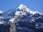
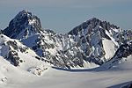
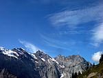
The Wildi Frau is a mountain of the Bernese Alps, overlooking the Hohtürli Pass in the Bernese Oberland. It lies between the valleys of Kandersteg and Kiental, north of the Blüemlisalp. It lies 60 km at the southwest of the capital, Bern. Its highest point is at 3,274 m (10,741 ft) above the sea level, or 140 m above the surrounding terrain. The width on its base is 0.65 km. The terrain around the Wildi Frau is mainly rocky. The nearest peak is the Wyssi Frau, at 3,650 m above the sea level, 1.4 km at the south of the Wildi Frau. The nearest community is Frutigen, 13.6 km at the northwest of Wildi Frau. The area around the Wildi Frau is permanently covered with ice and snow and very sparsely populated, with 6 inhabitants per square kilometer.
Excerpt from the Wikipedia article Wildi Frau (License: CC BY-SA 3.0, Authors, Images).Wildi Frau
Geographical coordinates (GPS) Address Nearby Places Show on map
Geographical coordinates (GPS)
| Latitude | Longitude |
|---|---|
| N 46.504166666667 ° | E 7.78 ° |
Address
Hohtürli
3718
Bern, Switzerland
Open on Google Maps


