Akerselva

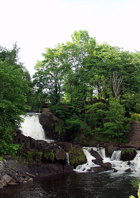
Akerselva or Akerselven (English: Aker River) is a river which flows through Oslo. It starts at Maridalsvannet in Oslomarka, and traverses the boroughs of Nordre Aker, Sagene, Grünerløkka, central Oslo and Grønland, whereby it finally ends at Paulsenkaien and Oset in Bjørvika. The river is considered to be a part of the Nordmarkvassdraget, and has the Norwegian watercourse number 006.Z. The entire river is about 8.2 kilometres (5.1 mi) long, and has a difference in elevation between source and mouth of approximately 149 metres (489 ft). In the past, the river was utilized as a source of energy for local industry, and along the river there are many old industrial buildings. In the 1970s, the river was heavily contaminated after 150 years of industrial and sewage discharge. In the 1980s, a local initiative to limit emissions and revive the flora and fauna of the river began.Akerselva has largely been rehabilitated is now "Oslo’s green lung" and along the bank of the entire river from Grønland to Maridalsvannet there are park areas. Salmon run and spawn in the upper part of the river. Early in March 2011, Oslo's water and wastewater department accidentally discharged 6,000 litres (1,600 US gal) of chlorine into the river near its headwaters, rendering the river virtually dead as of 11 March 2011. According to Norwegian Broadcasting Corporation, the discharge occurred at the water treatment plant Oset.
Excerpt from the Wikipedia article Akerselva (License: CC BY-SA 3.0, Authors, Images).Akerselva
Sørengutstikkeren, Oslo Gamle Oslo
Geographical coordinates (GPS) Address Nearby Places Show on map
Geographical coordinates (GPS)
| Latitude | Longitude |
|---|---|
| N 59.9 ° | E 10.75 ° |
Address
Sørenga Sjøbad
Sørengutstikkeren
0140 Oslo, Gamle Oslo
Norway
Open on Google Maps


