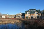
Mount Agamenticus

Mount Agamenticus is a 692 ft (211 m) high monadnock in the town of York, Maine. The area surrounding the summit is a park reservation which provides habitat for wildlife and a venue for recreation. The greater Agamenticus region covers nearly 30,000 acres (12,000 ha) in the southern Maine towns of Eliot, Ogunquit, South Berwick, Wells and York.Though under 700 ft (210 m) high, Mount Agamenticus was historically a noted landmark for sailors. It is high enough that from its peak on a clear day one can see the skyscrapers of Boston to the south, Cape Elizabeth and the entrance to Casco Bay to the north, and the Presidential Range, including Mount Washington, to the west. Looking out to sea, the Isles of Shoals - about 10 mi (16 km) off York - and Boon Island - about 6 mi (9.7 km) from the coast - are also clearly visible. The Agamenticus summit can be seen on a clear day from the lookout and the fire control tower at Halibut Point State Park in Rockport, Massachusetts. Mount Agamenticus is also affectionately known by older locals as "Big A," the nickname of a ski slope that once operated on its northeast flank, remnants of which can be seen both near the summit and along the trails. A memorial cairn to Mi'kmaq chief St. Aspinquid, who allegedly converted to Christianity, is located near the summit.
Excerpt from the Wikipedia article Mount Agamenticus (License: CC BY-SA 3.0, Authors, Images).Mount Agamenticus
Ring Trail,
Geographical coordinates (GPS) Address Nearby Places Show on map
Geographical coordinates (GPS)
| Latitude | Longitude |
|---|---|
| N 43.2231 ° | E -70.692 ° |
Address
Ring Trail 17
03902 , Cape Neddick
Maine, United States
Open on Google Maps


