Downtown Saint Paul

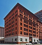
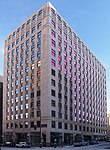
Downtown Saint Paul is an official neighborhood in Saint Paul, Minnesota, United States. Its boundaries are the Mississippi River to the south, University Avenue to the north, US 52 to the east, and Kellogg Avenue to the west. It is bounded by the Dayton's Bluff, Summit-University, West Seventh, Frogtown, West Side, and Payne-Phalen neighborhoods. The West Side neighborhood is on the other side of the river, and can be accessed via the Robert Street Bridge or the Wabasha Street Bridge. Interstate 35E and Interstate 94 run through the north side of the neighborhood, providing a separation between the Minnesota State Capitol and other state government buildings with the rest of downtown.
Excerpt from the Wikipedia article Downtown Saint Paul (License: CC BY-SA 3.0, Authors, Images).Downtown Saint Paul
Saint Paul Skyway, Saint Paul Downtown
Geographical coordinates (GPS) Address Nearby Places Show on map
Geographical coordinates (GPS)
| Latitude | Longitude |
|---|---|
| N 44.947222222222 ° | E -93.091666666667 ° |
Address
US Bank Building
Saint Paul Skyway
55101 Saint Paul, Downtown
Minnesota, United States
Open on Google Maps


