Weston, Nottinghamshire
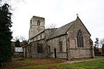
Weston is a village in Nottinghamshire, England. It is located 10 miles south of Retford. According to the 2001 census it had a population of 312, increasing to 393 (and including Grassthorpe) at the 2011 Census. The parish church of All Saints is 13th century. At the south-east end of the village are three 16th century tenements built with cruck trusses.In 1870–72, John Marius Wilson's Imperial Gazetteer of England and Wales described Weston like this: "WESTON, a parish, with a village, in Southwell district, Notts; on the Great Northern railway, 3 miles NNW of Carlton-on-Trent. Post town, Newark. Acres, 1,690. Real property, £2,745. Pop., 380. Houses, 85. The manor belongs to Earl Manvers. The living is a rectory in the diocese of Lincoln. Value, £500. Patron, Earl Manvers. The church was recently repaired, and has a tower and spire. There are a Wesleyan chapel and an endowed school."
Excerpt from the Wikipedia article Weston, Nottinghamshire (License: CC BY-SA 3.0, Authors).Weston, Nottinghamshire
Infield Lane, Newark and Sherwood
Geographical coordinates (GPS) Address Nearby Places Show on map
Geographical coordinates (GPS)
| Latitude | Longitude |
|---|---|
| N 53.2 ° | E -0.84 ° |
Address
Infield Lane
Infield Lane
NG23 6SX Newark and Sherwood
England, United Kingdom
Open on Google Maps


