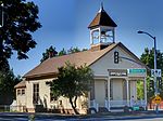
Mather Air Force Base
1918 establishments in California1993 disestablishments in CaliforniaAerospace Defense Command military installationsGeographic coordinate listsHistory of Sacramento County, California ... and 13 more
Initial United States Air Force installationsInstallations of Strategic Air CommandInstallations of the United States Air Force in CaliforniaJoint Surveillance System radar stationsLists of coordinatesMilitary Superfund sitesMilitary installations closed in 1993Military installations established in 1918Permanent System radar stationsRadar stations of the United States Air ForceSuperfund sites in CaliforniaUSAF Air Training Command InstallationsUse American English from December 2018

Mather Air Force Base (Mather AFB) was a United States Air Force Base, which was closed in 1993 pursuant to a post-Cold War BRAC decision. It was located 12 miles (19 km) east of Sacramento, on the south side of U.S. Route 50 in Sacramento County, California. Mather Field was one of 32 Air Service training camps established after the United States entry into World War I in April 1917.The Mather AFB land has various post-military uses including Sacramento Mather Airport, established in 1995. Some of the land was included in the City of Rancho Cordova, when it was incorporated in 2003.
Excerpt from the Wikipedia article Mather Air Force Base (License: CC BY-SA 3.0, Authors, Images).Mather Air Force Base
Truemper Way,
Geographical coordinates (GPS) Address Nearby Places Show on map
Geographical coordinates (GPS)
| Latitude | Longitude |
|---|---|
| N 38.553888888889 ° | E -121.2975 ° |
Address
Truemper Way
95655
California, United States
Open on Google Maps


