Heydour
Civil parishes in LincolnshireOpenDomesdaySouth Kesteven DistrictUse British English from February 2014Villages in Lincolnshire

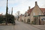
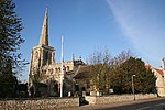
Heydour is a hamlet and civil parish in the South Kesteven district of Lincolnshire, England. The parish population of 286 at the 2001 census rose to 311 at the 2011 census. Heydour lies about 5 miles (8 km) south-west of Sleaford and 6 miles (10 km) north-east of Grantham. It forms a group of parish hamlets with Kelby, Culverthorpe, Oasby and Aisby.
Excerpt from the Wikipedia article Heydour (License: CC BY-SA 3.0, Authors, Images).Heydour
Church Lees, South Kesteven
Geographical coordinates (GPS) Address Nearby Places Show on map
Geographical coordinates (GPS)
| Latitude | Longitude |
|---|---|
| N 52.944 ° | E -0.499 ° |
Address
Church Lees
Church Lees
NG32 3NG South Kesteven
England, United Kingdom
Open on Google Maps


