Scarborough Centre (electoral district)

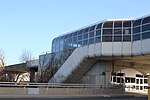
Scarborough Centre (French: Scarborough-Centre) is a federal electoral district in Ontario, Canada, that has been represented in the House of Commons of Canada since 1979. The riding was created in 1976 from parts of Scarborough East, Scarborough West and York—Scarborough ridings. It consists of the part of the Scarborough district of the City of Toronto bounded: on the west by Victoria Park Avenue, on the north by Highway 401, on the east by McCowan Road, Lawrence Avenue East and Bellamy Road North, and on the south by Eglinton Avenue East.Notable landmarks in Scarborough Centre include: Scarborough Civic Centre, site of east Toronto district council meetings, and adjacent Albert Campbell Square Scarborough Town Centre, a large shopping mall Scarborough Centre Line 3 station Scarborough General Hospital, General Division Scarborough Historical MuseumIt has been represented in the House of Commons by Liberal MP Salma Zahid since 2015.
Excerpt from the Wikipedia article Scarborough Centre (electoral district) (License: CC BY-SA 3.0, Authors, Images).Scarborough Centre (electoral district)
Nantucket Boulevard, Toronto Scarborough
Geographical coordinates (GPS) Address Nearby Places Show on map
Geographical coordinates (GPS)
| Latitude | Longitude |
|---|---|
| N 43.753 ° | E -79.273 ° |
Address
Nantucket Boulevard 22
M1P 4X1 Toronto, Scarborough
Ontario, Canada
Open on Google Maps


