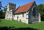
Potterspury
Civil parishes in NorthamptonshireUse British English from March 2014Villages in NorthamptonshireWest Northamptonshire District

Potterspury is a populous village and civil parish in West Northamptonshire, England. The nearest main town is Milton Keynes, the centre of which is about 7 miles south-east. At the time of the 2011 census, the parish's population (including Furtho) was 1,453 people.The village's name is a concatenation. It was originally cognate with Perry and sometimes written as such, implying pear tree or orchard. Several places are named such regionally. The helpful (disambiguatory) prefix 'Potters', seen by the 15th century, is a nod to the very old, important potteries here. An alternative is "Estpury", seen in 1452.
Excerpt from the Wikipedia article Potterspury (License: CC BY-SA 3.0, Authors, Images).Potterspury
Blackwell End,
Geographical coordinates (GPS) Address Nearby Places Show on map
Geographical coordinates (GPS)
| Latitude | Longitude |
|---|---|
| N 52.0858 ° | E -0.8977 ° |
Address
Blackwell End
Blackwell End
NN12 7QE
England, United Kingdom
Open on Google Maps


