place

Caprino, Switzerland

LuganoTicino geography stubsVillages in Ticino
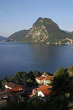
Caprino village from Lake Lugano

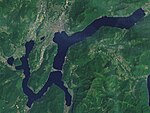
Caprino is a village on the southern shore of Lake Lugano in the Swiss canton of Ticino, to the east of the Italian exclave of Campione d'Italia and below the summit of Sighignola. Some 0.5 kilometres (0.31 mi) east of Caprino village is Cantine di Caprino, a smaller settlement. Politically both form part of the Castagnola-Cassarate quarter of the city of Lugano, although until 1972 Castagnola-Cassarate was an independent municipality under the name Castagnola.Caprino has no direct road connection with rest of the city of Lugano, or indeed the bulk of its quarter of Castagnola-Cassarate, which lie on the other side of Lake Lugano. An indirect road connection can be made via Arogno, Maroggia and the Melide causeway, but by this route Castagnola is some 21 kilometres (13 mi) distant, compared to under 2 kilometres (1.2 mi) across the lake. Cantine di Caprino has no road access, although it is linked to Caprino village by a footpath.Boats of the Società Navigazione del Lago di Lugano (SNL) provide several crossings a day to central Lugano. Boats call at San Rocco landing stage in Caprino village and at Cantine di Caprino. Water taxis are also available.

Excerpt from the Wikipedia article Caprino, Switzerland (License: CC BY-SA 3.0, Authors, Images).

Caprino, Switzerland
Via al Lago,

Geographical coordinates (GPS) Address Nearby Places
placeShow on map

Wikipedia: Caprino, SwitzerlandContinue reading on Wikipedia

Geographical coordinates (GPS)

Latitude Longitude
N 45.984166666667 ° E 8.9797222222222 °
placeShow on map

Address

Via al Lago

Via al Lago
6823 (Circolo di Lugano est)
Ticino, Switzerland
mapOpen on Google Maps

Caprino village from Lake Lugano
Share experience

Nearby Places

Brè-Aldesago
Brè-Aldesago

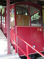
Brè-Aldesago is a quarter of the city of Lugano, in the Swiss canton of Ticino. It occupies the slopes and summit of Monte Brè, and contains the mountain villages of Brè, to the east of the summit, and Aldesago, to the west. It has an area of 420 hectares (1,000 acres) and, in 2011, it had a population of 1,055.Historically, Brè-Aldesago was an independent municipality, known simply as Brè until 1953. The municipality had 178 inhabitants in 1591, which increased to 244 in 1801, 378 in 1850, 393 in 1900, 400 in 1950 and 411 in 1970. It was incorporated into Lugano in 1972.Brè was first recorded in 1280 as de Bre, and for most of its history has lived by agriculture and livestock. Until 1912, the only access to the village was on foot or by mule, but in that year Brè was reached by a road from Lugano via Aldesago, and the Monte Brè funicular was opened between Lugano and the summit of Monte Brè. Subsequently, Brè-Aldesago has become a resort and residential suburb.The Brè-Aldesago quarter is accessed by a steep and winding road from Lugano. This first climbs to Aldesago village, before crossing the southern slopes of Monte Brè to reach Brè village. A further road ascends from near Brè village to near the summit of Monte Brè. Trasporti Pubblici Luganesi (TPL) bus route 12 operates from Lugano city centre to Brè village via Aldesago village, with one or two buses per hour. The Monte Brè funicular connects the Lugano suburb of Cassarate, itself served by frequent city buses, to the summit of Monte Brè, running every half-hour.The summit of Monte Brè is a significant tourist attraction, with expansive views over Lake Lugano and the Alps, and several restaurants. Brè village is the home of the Wilhelm Schmid Museum, which contains a collection of works by Wilhelm Schmid (1892–1971), together with an artistic trail that includes the works of 20 nationally and internationally acclaimed artists.