Groton, Suffolk

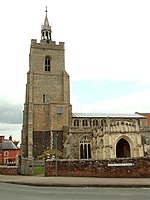
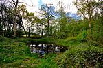
Groton is a village and civil parish in the Babergh district, Suffolk, England, located around a mile north of the A1071 between Hadleigh and Sudbury. In 2021 the parish had a population of 299.The parish church dedicated to Saint Bartholomew is flint faced and has some 15th-century features; it was heavily restored in the 19th century. It is a Commonwealth War Grave site. The village has no shops but does have the pub the Fox and Hounds. In addition to Groton village, the parish contains the hamlets of Broad Street, Castling's Heath, Gosling Green, Horner's Green, and Parliament Heath. It is home to several Ancient Woodlands: the Groton Wood SSSI, the Mill Wood and Winding Wood nature reserves, and a section of Bull's Cross Wood (part of the Milden Thicks SSSI). Also found in the parish are a tributary to the River Box and Pitches Mount, the remaining earthworks of a wooden castle. The parish borders Boxford, Edwardstone, Kersey, Lindsey and Milden. There are 21 listed buildings in Groton.
Excerpt from the Wikipedia article Groton, Suffolk (License: CC BY-SA 3.0, Authors, Images).Groton, Suffolk
Babergh
Geographical coordinates (GPS) Address Nearby Places Show on map
Geographical coordinates (GPS)
| Latitude | Longitude |
|---|---|
| N 52.038 ° | E 0.857 ° |
Address
CO10 5HB Babergh
England, United Kingdom
Open on Google Maps


