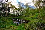
Boxford, Suffolk
Babergh DistrictBoxford, SuffolkCivil parishes in SuffolkVillages in Suffolk

Boxford is a village and civil parish in the Babergh district of Suffolk, England. Located around six miles east of Sudbury straddling the River Box and skirted by the Holbrook. The parish includes the hamlets of Calais Street, Hagmore Green and Stone Street. In 2021 the built-up area had a population of 833. In 2021 the parish had a population of 1403. The parish borders Assington, Edwardstone, Groton, Kersey, Newton and Polstead. There are 87 listed buildings in Boxford. Boxford became a conservation area in 1973.
Excerpt from the Wikipedia article Boxford, Suffolk (License: CC BY-SA 3.0, Authors, Images).Boxford, Suffolk
Cox Hill, Babergh Boxford
Geographical coordinates (GPS) Address Nearby Places Show on map
Geographical coordinates (GPS)
| Latitude | Longitude |
|---|---|
| N 52.033 ° | E 0.867 ° |
Address
Cox Hill
Cox Hill
CO10 5HR Babergh, Boxford
England, United Kingdom
Open on Google Maps


