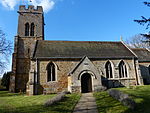
East Carlton
Civil parishes in NorthamptonshireCountry houses in NorthamptonshireHistory of NorthamptonshireNorth NorthamptonshireTourist attractions in Northamptonshire ... and 2 more
Use British English from March 2014Villages in Northamptonshire

East Carlton is a village and civil parish in the county of Northamptonshire, on the southern ridge overlooking the Welland valley to the north and covers 1,645 acres (666 ha) on a long strip of land. It is 2 miles (3.2 km) west of the town of Corby and is administered as part of North Northamptonshire but was previously in the Corby borough until 2021. At the time of the 2001 census, the parish's population was 270, reducing to 259 at the 2011 census. East Carlton is one of the Thankful Villages that suffered no fatalities during World War I. Although in Northamptonshire, the village is in the Leicestershire LE16 postcode area.
Excerpt from the Wikipedia article East Carlton (License: CC BY-SA 3.0, Authors, Images).East Carlton
Wire Lane,
Geographical coordinates (GPS) Address Nearby Places Show on map
Geographical coordinates (GPS)
| Latitude | Longitude |
|---|---|
| N 52.4972 ° | E -0.7862 ° |
Address
Wire Lane
Wire Lane
LE16 8ET , East Carlton
England, United Kingdom
Open on Google Maps


