place

Newark Liberty International Airport Station

Airport railway stations in the United StatesAmtrak stations in New JerseyNJ Transit Rail Operations stationsNewark Liberty International AirportPATH stations in New Jersey
Pages with non-numeric formatnum argumentsPort Authority of New York and New Jersey AirTrainRailway stations in Essex County, New JerseyRailway stations in the United States opened in 2001Stations on the Northeast CorridorTransportation in Newark, New JerseyUse mdy dates from May 2023
NJT train Newark Airport Station NJ1

Newark Liberty International Airport Station (Newark Airport Rail Station, often announced simply as Newark Airport) is a railroad station on the Northeast Corridor (NEC) in Newark, New Jersey. The station provides access to Newark Liberty International Airport (EWR) via the AirTrain monorail which connects the station to the airport's terminals and parking areas. It is served by New Jersey Transit's (NJT) Northeast Corridor Line and North Jersey Coast Line and Amtrak's Northeast Regional and Keystone Service trains. The station, located in the Dayton neighborhood of the city, is accessible only by train. There is no direct pedestrian access, bus service, parking facility, or drop-off area, although all are available at the airport.

Excerpt from the Wikipedia article Newark Liberty International Airport Station (License: CC BY-SA 3.0, Authors, Images).

Newark Liberty International Airport Station
Station Road, Newark

Geographical coordinates (GPS) Address External links Nearby Places
placeShow on map

Wikipedia: Newark Liberty International Airport StationContinue reading on Wikipedia

Geographical coordinates (GPS)

Latitude Longitude
N 40.704444444444 ° E -74.190555555556 °
placeShow on map

Address

Newark Liberty Airport

Station Road
07114 Newark
New Jersey, United States
mapOpen on Google Maps

linkWikiData (Q14705806)
linkOpenStreetMap (7015002886)

NJT train Newark Airport Station NJ1
Share experience

Nearby Places

Lehigh Line Connection

The Lehigh Line Connection connects Amtrak's Northeast Corridor (NEC) with the Conrail Lehigh Line 2 miles (3.2 km) south of downtown Newark, New Jersey. It leaves the NEC at Hunter Interlocking, and the line is sometimes called the Hunter Connection. Used by New Jersey Transit (NJT) Raritan Valley Line trains since 1997 when it replaced an older connection, it splits from the NEC just north of the former connector, with wider radius curves with a maximum speed of 45 mph, compared to the 15 mph of the original alignment. The old connection had a single track with older overhead wire and Pennsylvania Railroad (PRR) signaling. Until 1961 Lehigh Valley Railroad (LV) passenger trains bound to/from New York Penn Station, such as the Black Diamond, used the connection to reach their own railroad from the PRR main line. At the top of the hill at NK interlocking, LV diesels exchanged the train(s) with PRR electric locomotives. Despite the lack of electrification on the line past the connection, the new trackage is also equipped with catenary wire. Amtrak and NJT have proposed constructing the Hunter Flyover, which would carry Newark-bound Raritan Valley Line trains up and over the six-track NEC main line. Currently, Raritan Valley trains heading toward Newark have to cross three or four tracks at grade to access the eastbound tracks at Newark. This flyover would remove many directional conflicts between trains and reduce delays on the NEC. The project would cost $250 million and is currently undergoing environmental analysis.

Clinton Hill, Newark

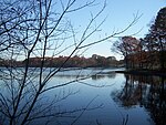
Clinton Hill is a neighborhood within the south-central portion of the city of Newark in Essex County, New Jersey, United States. It is centered at Clinton Avenue, and bounded roughly by Elizabeth Avenue in the east, Hawthorne Avenue in the south, Avon Avenue in the north, and Irvington in the west. Upper Clinton Hill is predominantly residential, with many of the homes also being the offices of professionals. Most retail activity along Clinton and Hawthorne Avenues is in the form of neighborhood-oriented convenience-type stores. Residents can patronize a shopping center on Chancellor Avenue near the Irvington border or one on nearby Springfield Ave. Nearest to the commercial streets, the housing is largely two- and three-family conversions, while the interior streets include many large, well-maintained single-family houses. To the south, near I-78, are several vacant and abandoned properties. There is some light industry in the southeastern part of the neighborhood. Hawthorne Hill is the southwest section of Upper Clinton Hill. The Hawthorne Hill/Upper Clinton Hill neighborhoods are served by the Newark Public Library's Madison branch. M&M's first factory was at 285 Badger Avenue in the neighborhood. It is now a vacant lot.Newark's highest concentration of vacant land and empty buildings can be found in the Lower Clinton Hill neighborhood. Whole blocks of vacant land can be seen, much of it cleared of all but a few clusters of older residences. Indeed, more than half the neighborhood is vacant land. There is some commercial activity along Avon Avenue and at the intersection of Peddie Street and Elizabeth Avenue and a scattering of small, convenience-oriented businesses on Clinton Avenue and Bergen Street. The Lower Clinton Hill neighborhood is served by the Newark Public Library's Clinton branch.

Dayton, Newark

Dayton is a neighborhood within the city of Newark in Essex County, New Jersey. It is part of the city's south ward and was named after Jonathan Dayton, a Founding Father of the United States. The area is bounded on the north by Peddie Street (Thomas Baldwin Peddie), on the east by Newark Liberty International Airport, on the south by Elizabeth, and on the west by Elizabeth Avenue. The main road through the neighborhood is Frelinghuysen Avenue, but it is surrounded by U.S. Route 1/9, Interstate 78 and U.S. Route 22. The neighborhood of Dayton encompasses all of Weequahic Park, the second largest park in Newark. The park includes an 80-acre (320,000 m2) lake, Weequahic Golf Course and an old racetrack now used for jogging. The park has gospel and jazz concerts at night. The park is bisected by US 22 and the larger, southern section of the park (including Weequahic Lake) is easily accessible to Dayton.Jonathan Dayton (October 16, 1760 – October 9, 1824) was an American politician from the U.S. state of New Jersey. He was the youngest person to sign the United States Constitution and a member of the U.S. House of Representatives, serving as the fourth Speaker of the United States House of Representatives, and later the U.S. Senate. Years ago, the area of Dayton was also known for Twin City, a skating rink located on the Newark-Elizabeth border in the area of Virginia Street. St.Thomas Aquinas RC Church is located on Ludlow St. There is one train station in Dayton, Newark Liberty International Airport, served by New Jersey Transit's Northeast Corridor Line and North Jersey Coast Line, and Amtrak's Northeast Regional and Keystone Service. The station was built in 2001 to connect NJT's commuter lines and Amtrak's Northeast Corridor services with the airport's AirTrain system. It opened four years after service was run between terminals on the AirTrain. The station is only a transfer station and not publicly accessible by any roads. Proposal to extend PATH service to the airport may include a station at Dayton.