Clinton Hill, Newark

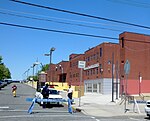
Clinton Hill is a neighborhood within the south-central portion of the city of Newark in Essex County, New Jersey, United States. It is centered at Clinton Avenue, and bounded roughly by Elizabeth Avenue in the east, Hawthorne Avenue in the south, Avon Avenue in the north, and Irvington in the west. Upper Clinton Hill is predominantly residential, with many of the homes also being the offices of professionals. Most retail activity along Clinton and Hawthorne Avenues is in the form of neighborhood-oriented convenience-type stores. Residents can patronize a shopping center on Chancellor Avenue near the Irvington border or one on nearby Springfield Ave. Nearest to the commercial streets, the housing is largely two- and three-family conversions, while the interior streets include many large, well-maintained single-family houses. To the south, near I-78, are several vacant and abandoned properties. There is some light industry in the southeastern part of the neighborhood. Hawthorne Hill is the southwest section of Upper Clinton Hill. The Hawthorne Hill/Upper Clinton Hill neighborhoods are served by the Newark Public Library's Madison branch. M&M's first factory was at 285 Badger Avenue in the neighborhood. It is now a vacant lot.Newark's highest concentration of vacant land and empty buildings can be found in the Lower Clinton Hill neighborhood. Whole blocks of vacant land can be seen, much of it cleared of all but a few clusters of older residences. Indeed, more than half the neighborhood is vacant land. There is some commercial activity along Avon Avenue and at the intersection of Peddie Street and Elizabeth Avenue and a scattering of small, convenience-oriented businesses on Clinton Avenue and Bergen Street. The Lower Clinton Hill neighborhood is served by the Newark Public Library's Clinton branch.
Excerpt from the Wikipedia article Clinton Hill, Newark (License: CC BY-SA 3.0, Authors, Images).Clinton Hill, Newark
Badger Avenue, Newark
Geographical coordinates (GPS) Address Nearby Places Show on map
Geographical coordinates (GPS)
| Latitude | Longitude |
|---|---|
| N 40.717777777778 ° | E -74.1975 ° |
Address
Badger Avenue 230
07112 Newark
New Jersey, United States
Open on Google Maps


