Harringworth
Civil parishes in NorthamptonshireNorth NorthamptonshireNorthamptonshire geography stubsOpenDomesdayUse British English from March 2014 ... and 1 more
Villages in Northamptonshire

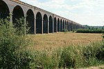
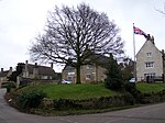
Harringworth is a village and civil parish in North Northamptonshire, England. It is located close to the border with Rutland, on the southern bank of the River Welland, and around 5.3 miles (8.5 km) north of Corby. At the 2001 Census, the population of the parish was 247, falling to 241 at the 2011 Census.The area is dominated by the Welland Viaduct (known locally as the Harringworth Viaduct) that gracefully crosses the Welland and its flood plain immediately to the west of the village.
Excerpt from the Wikipedia article Harringworth (License: CC BY-SA 3.0, Authors, Images).Harringworth
Seaton Road,
Geographical coordinates (GPS) Address Nearby Places Show on map
Geographical coordinates (GPS)
| Latitude | Longitude |
|---|---|
| N 52.5676 ° | E -0.6515 ° |
Address
Seaton Road
Seaton Road
NN17 3AF , Harringworth
England, United Kingdom
Open on Google Maps


