Lambourne
Civil parishes in EssexEpping Forest DistrictVillages in Essex

Lambourne is a civil parish in the Epping Forest district of Essex, England. It is located approximately 4.5 miles (7 km) South of Epping and 5 miles (8 km) northwest of Romford. It covers an area of 2,590 acres (1,050 ha), and in 2001 its population was 1,828, increasing to 2,013 at the 2011 Census.
Excerpt from the Wikipedia article Lambourne (License: CC BY-SA 3.0, Authors, Images).Lambourne
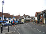
New Road, Epping Forest Lambourne
Geographical coordinates (GPS) Address Nearby Places Show on map
Geographical coordinates (GPS)
| Latitude | Longitude |
|---|---|
| N 51.638 ° | E 0.13 ° |
Address
New Road
RM4 1AS Epping Forest, Lambourne
England, United Kingdom
Open on Google Maps


