place

Depew, New York

Buffalo–Niagara Falls metropolitan areaVillages in Erie County, New YorkVillages in New York (state)
Erie County New York incorporated and unincorporated areas Depew highlighted

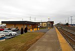
Depew () is a village in Erie County, New York. The population was 15,303 at the time of the 2010 census. It is part of the Buffalo–Niagara Falls metropolitan area. The village is named for Chauncey Depew, a politician and one of the original investors who bought the land for the village, which was incorporated in 1894. The village extends across the boundary between the towns of Lancaster and Cheektowaga. The village lies on both sides of NY Route 78 (Transit Road), a major north-south route. Village residents voted on January 17, 2017 to not dissolve the Village of Depew into the Towns of Lancaster and Cheektowaga, by a margin of 3,006–1,165.

Excerpt from the Wikipedia article Depew, New York (License: CC BY-SA 3.0, Authors, Images).

Depew, New York
Walden Avenue,

Geographical coordinates (GPS) Address Nearby Places
placeShow on map

Wikipedia: Depew, New YorkContinue reading on Wikipedia

Geographical coordinates (GPS)

Latitude Longitude
N 42.911666666667 ° E -78.701666666667 °
placeShow on map

Address

Walden Avenue 3218
14043
New York, United States
mapOpen on Google Maps

Erie County New York incorporated and unincorporated areas Depew highlighted
Share experience

Nearby Places

Pfohl Brothers Landfill

The 120-acre (0.49 km2) Pfohl Brothers Landfill was a privately owned and operated landfill in Cheektowaga, New York. The landfill accepted municipal and industrial wastes from 1932 until 1971. It is located 1/2 mile east of the Buffalo Niagara International Airport and sits on the north bank of Ellicott Creek. It lies west of Transit Road and south of the New York State Thruway near Thruway Exit 49. It is bisected by Aero Drive. When the landfill was active, it received solid and liquid chemical waste and sludges, including heavy metals, such as mercury and barium, and volatile organic compounds (VOCs), such as benzene and dioxins, from local businesses, such as paint manufacturers, electroplaters, printers, and other industries that used solvents and petroleum. On May 10, 1993, the Pfohl Brothers Landfill was classified for cleanup by the United States Environmental Protection Agency as Superfund site NYD980507495. Remediation done by the New York State Department of Environmental Conservation including the removal of 4,734 on-site drums, as well as the containment of the landfill, has significantly reduced the potential for exposure to contaminated materials at the site. Access to most of the site is restricted by a fence, but drainage ditches with runoff from the landfill lie outside of the fenced area and are accessible to the public. Several drainage ditches discharge into Ellicott Creek. Aero Lake lies north of the site. Both the lake and the creek are used by the community for recreational fishing. Ten homes are located within 200 feet (61 m) of an area of contaminated soil. The area near the landfill is residential and commercial. Wetlands border the creek and a drainage ditch and a wetland was located on what is now the central portion of the property.