place

Bay Head, New Jersey

1886 establishments in New JerseyBay Head, New JerseyBorough form of New Jersey governmentBoroughs in Ocean County, New JerseyJersey Shore communities in Ocean County
Populated places established in 1886Use American English from March 2020Use mdy dates from March 2020
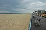
Sunrise at Bay Head Beach

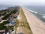
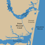
Bay Head is a borough situated on the Jersey Shore in northern Ocean County, in the U.S. state of New Jersey. As of the 2020 United States census, the borough's population was 930, a decrease of 38 (−3.9%) from the 2010 census count of 968, which in turn reflected a decline of 270 (−21.8%) from the 1,238 counted in the 2000 census. Bay Head is situated on the Barnegat Peninsula, also known as Barnegat Bay Island, a long, narrow barrier island that separates Barnegat Bay from the Atlantic Ocean. Together with Mantoloking, Bay Head is considered part of the Jersey Shore's "Gold Coast".Bay Head was incorporated as a borough by an act of the New Jersey Legislature on June 15, 1886, from portions of Brick Township, based on the results of a referendum held three days earlier.The community was supposed to have been named "Bayhead" after the Bayhead Land Company that developed the area in the 1870s. A railroad sign posted in the 1880s labeled the station as "Bay Head," and the name stuck when the borough was incorporated in 1886. The name also comes from the town's location, which is at the "head" of Barnegat Bay.

Excerpt from the Wikipedia article Bay Head, New Jersey (License: CC BY-SA 3.0, Authors, Images).

Bay Head, New Jersey
Grove Street,

Geographical coordinates (GPS) Address Nearby Places
placeShow on map

Wikipedia: Bay Head, New JerseyContinue reading on Wikipedia

Geographical coordinates (GPS)

Latitude Longitude
N 40.070315 ° E -74.048162 °
placeShow on map

Address

Grove Street 114
08742
New Jersey, United States
mapOpen on Google Maps

Sunrise at Bay Head Beach
Share experience

Nearby Places

Mantoloking, New Jersey

Mantoloking (, MAN-ta-LO-king)) is a coastal borough in Ocean County, in the U.S. state of New Jersey. As of the 2020 United States census, the borough's population was 331, an increase of 35 (+11.8%) from the 2010 census count of 296, which in turn reflected a decline of 127 (−30.0%) from the 423 counted in the 2000 census. The borough has an estimated summer population of approximately 5,000.As of the 2000 census, Mantoloking was the highest-income community in the state of New Jersey with a per capita money income of $114,017 as of 1999, an increase of 29.8% from the $87,830 recorded in 1989. Based on data from the 2006–2010 American Community Survey, the borough had a per-capita income of $97,938, ranked 4th in the state. In the Forbes magazine 2012 rankings of "America's Most Expensive ZIP Codes", the borough was ranked 139th, with a median price of $1,403,349.Mantoloking was incorporated as a borough by an act of the New Jersey Legislature on April 10, 1911, from portions of Brick Township. The name Mantoloking is derived from the Unami language of the Lenni Lenape Native Americans who once inhabited New Jersey. Various meanings have been attributed to the community's name including "frog ground" or "sand place".The borough is a Jersey Shore community situated on the Barnegat Peninsula, also known as Barnegat Bay Island, a long, narrow barrier island that separates Barnegat Bay from the Atlantic Ocean. The town is linked to the New Jersey-mainland via the Mantoloking Bridge, linking the town with Brick Township across the Barnegat Bay. Mantoloking is home to the Olympic-champion producing Mantoloking Yacht Club. Some old "summer cottages" in the borough were designed by architect Stanford White of McKim, Mead & White. Together with Bay Head to the north, Mantoloking is considered part of the Jersey Shore's "Gold Coast". It is a dry town where alcohol is not permitted to be sold by law.

Point Pleasant Beach, New Jersey

Point Pleasant Beach is a coastal borough situated on the Jersey Shore, and the northernmost community directly facing the Atlantic Ocean within Ocean County, in the U.S. state of New Jersey. It lies at the northern end of the Barnegat Peninsula, which serves as a barrier island separating Barnegat Bay from the open Atlantic Ocean. The borough's name is derived from its location.As of the 2020 United States census, the borough's population was 4,766, an increase of 101 (+2.2%) from the 2010 census count of 4,665, which in turn reflected a decline of 649 (−12.2%) from the 5,314 counted in the 2000 census.Point Pleasant Beach was incorporated as a borough by an act of the New Jersey Legislature on May 18, 1886, from portions of Brick Township, subject to the results of a referendum passed the previous day. Point Pleasant Beach lies immediately to the east of Point Pleasant borough, an entirely separate municipality within Ocean County. The borough's boardwalk is approximately one mile long, spanning the coastline from the Manasquan Inlet at the north to New Jersey Avenue in the south. The central third of the boardwalk is largely amusement rides, the Jenkinson's Aquarium, the Jenkinsons Arcades, pizza joints, ice cream parlors, games-of-chance and miniature golf courses. There are fees of up to $10 per person age 12 or over to access the various beaches, as well as parking fees of up to $2.50 per hour or more.The beach was ranked eighth-best in New Jersey in the "2008 Top 10 Beaches Contest" sponsored by the New Jersey Marine Sciences Consortium.

Jersey Shore
Jersey Shore

The Jersey Shore (known by locals simply as the Shore) is the coastal region of the U.S. state of New Jersey. Geographically, the term encompasses about 141 miles (227 km) of oceanfront bordering the Atlantic Ocean, from Perth Amboy in the north to Cape May Point in the south. The region includes Middlesex, Monmouth, Ocean, Atlantic, and Cape May counties, which are in the central and southern parts of the state. Located in the center of the Northeast Megalopolis, the northern half of the shore region is part of the New York metropolitan area, while the southern half of the shore region is part of the Philadelphia metropolitan area, also known as the Delaware Valley. The Jersey Shore hosts the highest concentration of oceanside boardwalks in the United States. Famous for its wide beaches, many boardwalks with arcades, amusement parks, and water parks, the Jersey Shore is a popular vacation spot with residents of North Jersey, New York, Maryland, Delaware, Connecticut, and Pennsylvania. Certain shore communities are also popular with visitors of the Canadian province of Quebec. Due to New Jersey's peninsular geography, both sunrise and sunset are visible over water from different points on the Jersey Shore. Hurricane Sandy in 2012 devastated much of the northern part of the region, spawning the demolition and rebuilding of entire neighborhoods, with reinvention on a physically and financially elevated, and economically upscale level; this process of gentrification is rapidly escalating property values and transforming many communities on the Jersey Shore into a second home for the New York financial community, akin to the more established Gold Coast and Hamptons on Long Island.