place

Gilsum, New Hampshire

Towns in Cheshire County, New HampshireTowns in New HampshireUse mdy dates from July 2023
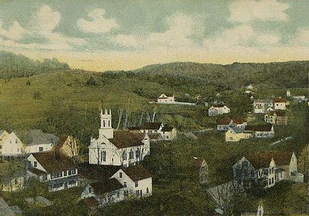
Bird's eye View of Gilsum, NH

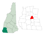
Gilsum is a town in Cheshire County, New Hampshire, United States. The population was 752 at the 2020 census. Home to Bear's Den Natural Area, Gilsum includes Gilsum Lower Village.

Excerpt from the Wikipedia article Gilsum, New Hampshire (License: CC BY-SA 3.0, Authors, Images).

Gilsum, New Hampshire
Memorial Street,

Geographical coordinates (GPS) Address Nearby Places
placeShow on map

Wikipedia: Gilsum, New HampshireContinue reading on Wikipedia

Geographical coordinates (GPS)

Latitude Longitude
N 43.048333333333 ° E -72.262777777778 °
placeShow on map

Address

Memorial Street 99
03448
New Hampshire, United States
mapOpen on Google Maps

Bird's eye View of Gilsum, NH
Share experience

Nearby Places

Gilsum Stone Arch Bridge

The Gilsum Stone Arch Bridge carries Surry Road over the Ashuelot River in Gilsum, New Hampshire. Built in 1862–63, it is one of the highest stone arch bridges in the state. It has a span of 47 feet 8 inches (14.53 m), and an average height over the river of 36 feet 6 inches (11.13 m). The roadway is 43 feet 6 inches (13.26 m) above the riverbed. It stands on the site of four previous bridges, where the river passes through a deep gorge. The previous bridge was also a stone arch bridge, which was built in 1860 and collapsed (due to inferior construction) a few months later. It was designed by William Leonard Kingsbury, a local official; its builders are not known because the town's records were destroyed in a fire. The present bridge's vault is carefully constructed from dry-laid granite voussoirs that were shaped for a very precise fit, with larger stones at the lower ends of the arch, and a smaller ones at the crown. Some of the stones were left with rough surfaces, while others were hammered smooth.In contrast to the fine stonework of the arch, the abutments and retaining walls are constructed of split-faced granite in irregular courses, wedged in place by stone chips. The northeast abutment continues along the river as a wing wall up to a massive stone pier, the former site of a mill dam. The southeast abutment is a granite reconstruction of coursed ashlar over concrete, done in 1951. The original granite coping which lined the roadway shoulders has been replaced by concrete with steel guard cables, c. 1920s.The bridge was listed on the National Register of Historic Places in 1989.