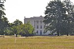
Sutton, West Sussex
Chichester DistrictIncomplete lists from November 2017Villages in West SussexWest Sussex geography stubs

Sutton is a village and civil parish in the District of Chichester in West Sussex, England, located six kilometres (4 miles) south of Petworth and east of the A285 road. The parish has a land area of 920 hectares (2272 acres). In the 2001 census 192 people lived in 83 households, of whom 83 were economically active. The 2011 Census population included the village of Barlavington and hamlet of Codmore Hill. The village has an Anglican church, St John the Baptist, and one pub, the White Horse.
Excerpt from the Wikipedia article Sutton, West Sussex (License: CC BY-SA 3.0, Authors, Images).Sutton, West Sussex
Barlavington Lane, Chichester Sutton
Geographical coordinates (GPS) Address Nearby Places Show on map
Geographical coordinates (GPS)
| Latitude | Longitude |
|---|---|
| N 50.92767 ° | E -0.60824 ° |
Address
Barlavington Lane
Barlavington Lane
RH20 1PS Chichester, Sutton
England, United Kingdom
Open on Google Maps


