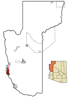
Mohave Valley

The Mohave Valley is a valley located mostly on the east shore of the south-flowing Colorado River in northwest Arizona. The valley extends into California's San Bernardino County; the northern side of the valley extends into extreme southeast Clark County, Nevada. The main part of the valley lies in southwest Mohave County, Arizona and is at the intersection of the southeast Mojave and northwest Sonoran deserts. The valley extends into the three states of California, Arizona and Nevada, and the Fort Mojave Indian Reservation extends into them as well. On the west, the valley borders the Dead Mountains of California which overlook the tri-state intersection point. Needles on Interstate 40 lies on the southwest margin of the valley overlooking the Havasu National Wildlife Refuge and Topock Marsh. The village of Topock is located at the south end of the valley where the Chemehuevi Mountains of California restrict the Colorado to the narrow Mohave Canyon.
Excerpt from the Wikipedia article Mohave Valley (License: CC BY-SA 3.0, Authors, Images).Mohave Valley
Jerome Road,
Geographical coordinates (GPS) Address Nearby Places Show on map
Geographical coordinates (GPS)
| Latitude | Longitude |
|---|---|
| N 34.956944444444 ° | E -114.58472222222 ° |
Address
Jerome Road
Jerome Road
86446
Arizona, United States
Open on Google Maps


