place

Fort Mojave Indian Reservation

American Indian reservations in ArizonaAmerican Indian reservations in CaliforniaAmerican Indian reservations in NevadaArizona populated places on the Colorado RiverCalifornia populated places on the Colorado River
Colorado River tribesCommunities in the Lower Colorado River ValleyFederally recognized tribes in the United StatesFort Mojave Indian Tribe of Arizona, California & NevadaPopulated places in Clark County, NevadaPopulated places in Mohave County, ArizonaPopulated places in San Bernardino County, California
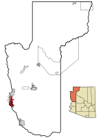
1235R Fort Mojave Reservation Locator Map

The Fort Mohave Indian Reservation is an Indian reservation along the Colorado River, currently encompassing 23,669 acres (95.79 km2) in Arizona, 12,633 acres (51.12 km2) in California, and 5,582 acres (22.59 km2) in Nevada. The reservation is home to approximately 1,100 members of the federally recognized Fort Mojave Indian Tribe of Arizona, California, and Nevada (Mohave: Pipa Aha Macav), a federally recognized tribe of Mohave people. Native Americans occupy less than 50 percent of the Mojave reservation. The Mohave people have leased much of their land to cotton, corn, and soybean farming companies, which employ a large population of resident European-Americans and Mexican Americans.The site of the former Fort Mohave and the eastern terminus of the Mojave Road are situated within the Fort Mojave Indian Reservation.

Excerpt from the Wikipedia article Fort Mojave Indian Reservation (License: CC BY-SA 3.0, Authors, Images).

Fort Mojave Indian Reservation
Hulet Avenue,

Geographical coordinates (GPS) Address Nearby Places
placeShow on map

Wikipedia: Fort Mojave Indian ReservationContinue reading on Wikipedia

Geographical coordinates (GPS)

Latitude Longitude
N 34.942777777778 ° E -114.60916666667 °
placeShow on map

Address

Hulet Avenue

Hulet Avenue
86446
Arizona, United States
mapOpen on Google Maps

1235R Fort Mojave Reservation Locator Map
Share experience

Nearby Places

Alexey W. Von Schmidt

The Von Schmidt State Boundary Monument was designated a California Historic Landmark (No.859) on April 26, 1973. In 1873 San Francisco civil engineer Allexey W. Von Schmidt built the State Boundary Monument in San Bernardino County, California near Needles, California. In 1872 and 1873 Von Schmidt did a survey of the border between California and Nevada/Arizona. The California Historic marker is on the dirt road, Pew Road, also called River Road, 2.6 Miles South of the State Line; 14 Miles North of Needles. The marker is not at the current state boundary, as Von Schmidt made an error in his survey. A new survey in 1893 showed that the Von Schmidt line was 1,600 to 1,800 feet off to the west. The marker is at the southern end of the California-Arizona State boundary. In 1872, a dispute arose between Nevada and California about the location of the state's boundary. Nevada wanted the state divide to be the same as the Sierra Nevada mountain range divide. California wanted the line to the east of the mountain range. When California attained statehood in 1850, it adopted 120 degrees west longitude as its eastern border. Between 1855 and 1900 there were six surveys to locate 120 degrees, with each locating 120 degrees of longitude differently. Von Schmidt applied for and was granted the contract to survey the state's frontier border east of the Sierra Nevada. In 1872 Von Schmidt using only a compass, a sextant and dead reckoning process set out with his crew to define the boundary. Von Schmidt was charged to measure and mark the boundary. Von Schmidt and his crew built stone markers and installed cast iron markers about one mile apart on the length of the state's boundary. Not many of the markers had foundations, so fewer remain today. A new survey in 1893 showed that the Von Schmidt line was 1,600 to 1,800 feet west of the actual 120 degrees. However, California and Nevada both recognize the 1872 Von Schmidt survey and the 1893 survey as the state line. Later the 1893 line was used. The exact location of the north-south California-Nevada border, between Lake Tahoe and the intersection of the southern boundary of Oregon at the 42nd parallel, was contentious and was surveyed and re-surveyed many time. One of the few iron markers that has survived is a near Verdi, Nevada this is a National Historic Landmark called the 1872 California-Nevada State Boundary Marker.