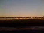
The Chester River is a major tributary of the Chesapeake Bay on the Delmarva Peninsula. It is about 43 miles (69 km) long, and its watershed encompasses 368 sq mi (950 km2), which includes 295 sq mi (760 km2) of land. Thus the total watershed area is 20% water. It forms the border between Kent County and Queen Anne's County, Maryland, with its headwaters extending into New Castle County and Kent County, Delaware. Chestertown, the seat of Maryland's Kent County, is located on its north shore. It is located south of the Sassafras River and north of Eastern Bay, and is connected with Eastern Bay through Kent Narrows.
The Chester River begins at Millington, Maryland, where Cypress Branch and Andover Branch join together. It ends at the Chesapeake Bay in a very wide mouth between Love Point on Kent Island, and Swan Point, near Gratitude, Maryland. Cypress Branch rises in southwestern New Castle County, Delaware, and Andover Branch, with its tributary, Sewell Branch, rises in northwestern Kent County, Delaware. Millington is the head of navigation. Sewell Branch and Andover Branch join in a private impoundage of approximately 30 acres (120,000 m2) about two miles (3 km) above joining with Cypress Branch and then becoming the Chester River.
Its main tributaries are Langford Creek and Morgan Creek on the north side and the Corsica River and Southeast Creek on the south side. There are also several small creeks on the northern shore, including Church Creek, Grays Inn Creek, Shippen Creek, Jarrett Creek, Browns Creek, Broad Creek, Dam Creek, Morgan Creek, Radcliffe Creek, and Mills Branch. On the southern shore the small creeks include Queenstown Creek, Tilghman Creek, Reed Creek, Grove Creek, Hambleton Creek, Rosin Creek, Foreman Branch and Unicorn Branch.


