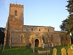
Nether Heyford

Nether Heyford is a village and civil parish in West Northamptonshire, England, close to the M1 motorway and the A5 and A45 roads, 6 miles (10 km) west of Northampton and 70 miles (113 km) northwest of London. The smaller village of Upper Heyford is about half a mile to the north. Nether Heyford takes its name from 'Hay ford'. Alternatively, 'hedge ford' or enclosure ford'. In 1086, in the Domesday Book, the name is recorded as "Heiforde". The Post Office once called the village Lower Heyford, but the name was restored to Nether Heyford after reference to it in local deeds. The village is on the flood plain of the River Nene and used to be subjected to flooding, as Watery Lane suggests. In 1699, a Roman pavement was found in Harestone Meadow to the east of the village.
Excerpt from the Wikipedia article Nether Heyford (License: CC BY-SA 3.0, Authors, Images).Nether Heyford
Geographical coordinates (GPS) Address Nearby Places Show on map
Geographical coordinates (GPS)
| Latitude | Longitude |
|---|---|
| N 52.227221 ° | E -1.030054 ° |
Address
NN7 3LY , Upper Heyford
England, United Kingdom
Open on Google Maps


