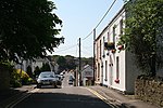
Gowerton (electoral ward)
Gower PeninsulaSwansea electoral wards

Gowerton (Welsh: Tregŵyr) is the name of an electoral ward in the county of Swansea, Wales, UK. It is named after Gowerton village which falls within the ward. The Gowerton community boundaries are coterminous with the ward. The electoral ward consists of some or all of the following areas: Gowerton, Penclawdd, Waunarlwydd, in the parliamentary constituency of Gower. It is bordered by Penclawdd and Fairwood to the south west; Killay North and Killay South to the south; Cockett to the east; and Lower Loughor, Upper Loughor, the Loughor estuary and Kingsbridge to the north. The turnout for Gowerton in the 2012 local council elections was 37.02%. The results were:
Excerpt from the Wikipedia article Gowerton (electoral ward) (License: CC BY-SA 3.0, Authors, Images).Gowerton (electoral ward)
Talbot Street,
Geographical coordinates (GPS) Address Phone number Website Nearby Places Show on map
Geographical coordinates (GPS)
| Latitude | Longitude |
|---|---|
| N 51.64507 ° | E -4.03924 ° |
Address
Ysgol Gyfun Gŵyr
Talbot Street
SA4 3DB , Gowerton
Wales, United Kingdom
Open on Google Maps


