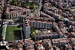
Horta-Guinardó

Horta-Guinardó (Catalan pronunciation: [ˈɔɾtə ɣinəɾˈðo]) is the name of one of the districts of Barcelona, located in its North-Eastern corner. It is named after two very heterogeneous areas of the city, Horta and el Guinardó, which together cover a large area of 11.92 km², amounting to 11.9% of the total area of the city. A former municipality that eventually became part of the city in the late 19th century, it is bordered by five out of ten districts of Barcelona (Gràcia, Nou Barris, Eixample, Sant Andreu and Sant Martí), and by two other municipalities of the metropolitan area (Sant Cugat and Cerdanyola del Vallès). It underwent rapid urbanisation process from the 1950s.
Excerpt from the Wikipedia article Horta-Guinardó (License: CC BY-SA 3.0, Authors, Images).Horta-Guinardó
Ronda del Guinardó, Barcelona
Geographical coordinates (GPS) Address Nearby Places Show on map
Geographical coordinates (GPS)
| Latitude | Longitude |
|---|---|
| N 41.413055555556 ° | E 2.1663888888889 ° |
Address
Casa de les Altures (Seu del Districte d'Horta-Guinardó)
Ronda del Guinardó 49, 51
08001 Barcelona (Horta-Guinardó)
Catalonia, Spain
Open on Google Maps


