place

Larnach Castle

1870s architecture in New ZealandBuildings and structures in DunedinCastles in New ZealandGardens in OtagoGothic Revival architecture in New Zealand
Heritage New Zealand Category 1 historic places in OtagoHistoric homes in New ZealandHistoric house museums in New ZealandHistory of DunedinHouses in New ZealandMuseums in DunedinOtago PeninsulaReportedly haunted locations in DunedinRobert Lawson buildingsScottish baronial architectureTourist attractions in DunedinUse New Zealand English from February 2020
Larnach Castle and fountain

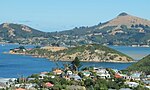
Larnach Castle (also referred to as "Larnach's Castle") is a mock castle on the ridge of the Otago Peninsula within the limits of the city of Dunedin, New Zealand, close to the small settlement of Pukehiki. It is one of a few houses of this scale in New Zealand. The house was built by the prominent entrepreneur and politician, William Larnach. Since 1967, the castle has been privately owned by the Barker family, and opened as a tourist attraction, as "New Zealand's only castle".The castle and grounds are open daily to members of the public. The Larnach Castle gardens are one of only five gardens nationwide to have been given the rating of "Garden of International Significance" by the New Zealand Gardens Trust. These were the first gardens in the South Island to receive the title. In 2018, Larnach Castle was designated a New Zealand Landmark by Heritage New Zealand.

Excerpt from the Wikipedia article Larnach Castle (License: CC BY-SA 3.0, Authors, Images).

Larnach Castle
Camp Track, Dunedin Broad Bay

Geographical coordinates (GPS) Address External links Nearby Places
placeShow on map

Wikipedia: Larnach CastleContinue reading on Wikipedia

Geographical coordinates (GPS)

Latitude Longitude
N -45.861659 ° E 170.627214 °
placeShow on map

Address

Larnach Castle

Camp Track
9014 Dunedin, Broad Bay
Otago, New Zealand
mapOpen on Google Maps

linkWikiData (Q1759455)
linkOpenStreetMap (288613442)

Larnach Castle and fountain
Share experience

Nearby Places

Broad Bay, New Zealand

The settlement of Broad Bay (Māori: Whaka Oho Rahi) is located on the Otago Harbour coast of Otago Peninsula, in the South Island of New Zealand. It is administered as part of the city of Dunedin, and is technically a suburb of that city, though its isolation and semi-rural nature make it appear as a settlement in its own right. Broad Bay is 13 kilometres (8.1 mi) to the east of the city centre, but due to the shape of the peninsula's coastline, the heart of the city cannot be seen from Broad Bay. A large bluff, Grassy Point, lies between Broad Bay and the harbourside settlements of Company Bay and Macandrew Bay to the west. The bluff is skirted by Portobello Road, the road which winds around the southeastern shore of the harbour between inner Dunedin and Portobello, 2 kilometres (1.2 mi) to the northeast of Broad Bay, and by the Otago Harbour Cycleway, which runs alongside it. The Camp Road walking track connects Broad Bay with Larnach Castle, close to the ridge of the peninsula. Broad Bay is situated on the shore of an aptly named wide bay (Broad Bay) and a smaller bay to the north east (Turnbulls Bay); between these lie a short peninsula (on which is sited the settlement's small historic cemetery), which terminates in the steep, finger-like headland of Yellowhead. The distinctive peak of Harbour Cone forms a backdrop to the settlement as seen from the harbour. The settlement is home to the heritage-listed Fletcher House, constructed in 1909 and restored in 1992, the first house by Fletcher Construction founder Sir James Fletcher. Like several settlements on the peninsula - including Portobello and Macandrew Bay, which lies 3 kilometres (1.9 mi) to the southwest - Broad Bay is a commuter settlement and a haven for alternative lifestylers. These settlements have a strong arts community, with many of their residents connected in some way with the visual or performing arts.

Macandrew Bay
Macandrew Bay

Macandrew Bay (Māori: Te Roto Pāteke) is located on the Otago Peninsula in the South Island of New Zealand. It is situated on the edge of Otago Harbour, and is named for pioneer Scottish settler James Macandrew who lived here during his later life. The Te Reo Māori name for the bay, Te Roto Pāteke, refers to the Brown teal (Māori: Pāteke) formerly prevalent in the area. Early European residents of the area called the bay "The Hundreds", due to the large number of boulders which covered the foreshore.Macandrew Bay is a suburb of Dunedin, but has the feel of an isolated coastal settlement and is often regarded as a separate township, even though the heart of the city is visible 10 kilometres away at the head of the harbour. It is both a commuter and a harbourside retreat from the city. The settlement centres on an area around the junction of Portobello Road and Greenacres Street, the latter a narrow road which rises steeply towards the interior of the Peninsula. Greenacres Street roughly follows the valley of the small Rodgers Creek. The community hall lies on the lower part of Greenacres Street close to its junction with Portobello Road, and the settlement's few shops lie immediately to the southwest of the junction. Behind these shops lie the community's primary school and cemetery, the latter of which includes the grave of James Macandrew. The bay has a small beach opposite the shops, which is well-used by the public. The beach was created artificially, with sand brought to the bay from the nearby Pacific coast. The area around the beach has been turned into a small public park, and landscaping of this was completed in 1979.Macandrew Bay is the largest of several settlements which lie on the harbour coast of Otago Peninsula. Between it and Dunedin lies Glenfalloch, a private gardens open to the public. Beyond Macandrew Bay to the northeast lie Company Bay and Raynbirds Bay and to the southwest is Colinswood, the latter named for James Macandrew's house. These small settlements could be considered "suburbs" of Macandrew Bay. Beyond Raynbirds Bay lie Broad Bay and Portobello. These settlements are connected to each other and to Dunedin's city centre by Portobello Road, a winding road which runs along the harbour coast of the peninsula, and by the Otago Harbour Cycleway, which runs alongside it Both the road and the sea wall which lies along the harbour edge were constructed by prison labour in the 1860s.A second route, Castlewood Road, rises from Company Bay to meet with Highcliff Road, which runs along the ridge of the peninsula from Dunedin to Portobello. Castlewood Road also connects with Camp Road, which lead to the stately home Larnach Castle, situated above Broad Bay.

Portobello, New Zealand

Portobello is a village beside the Otago Harbour halfway along the Otago Peninsula in Dunedin City, New Zealand. It lies at the foot of a small peninsula (Portobello Peninsula) between Portobello Bay and Latham Bay. Like scores of Dunedin features, Portobello was named after a locality in Edinburgh, Scotland, also called Portobello. At the end of Portobello Peninsula sits a marine research station, the Portobello Marine Laboratory, which is part of the University of Otago. Close to the end of this peninsula lies Quarantine Island / Kamau Taurua. Portobello features a Historical Society Museum, the 1908 Restaurant, a local primary school (Portobello School, Years 1-8), the old Portobello Hotel (a pub), a cafe and several accommodation providers, including a camping ground, bed and breakfasts and motels. A local dairy acts as the community's grocers, though most of the village's retail needs are served by Dunedin, which is easily accessed via the winding but well-surfaced Portobello Road which runs along the edge of the harbour. A multi-year project to raise and widen this road and add a 19km shared-use pathway is nearing completion, safely connecting Portobello to Dunedin for cyclists and walkers. This pathway is part of the larger Otago Harbour Cycleway. A more convoluted but scenic route, Highcliff Road, connects Portobello with Dunedin city centre via the ridge of the peninsula. Boating is an historical focus for Portobello. In the past, Portobello residents caught the ferry to the city, before the Portobello Road along the foreshore was constructed. Today, scheduled ferry service to Kamau Taurua and Port Chalmers departs from the recently renovated ferry jetty, a short distance from the centre of the village. A boating club maintains a slipway and boat shed near the jetty. Portobello Community Inc. is the local community group, which works to improve Portobello for its community.