place

Quarantine Island (New Zealand)

EngvarB from November 2017Geography of DunedinIslands of OtagoOtago HarbourPort Chalmers
Kamau Taurua (Quarantine Island) from Centenary lookout

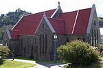
Quarantine Island (also known as Kamau Taurua and officially gazetted as Quarantine Island / Kamau Taurua), is the largest island in Otago Harbour, close to the city of Dunedin, New Zealand. The island covers an area of 15 hectares (37 acres), and is a publicly accessible recreation reserve. The buildings on the island are owned by Quarantine Island / Kamau Taurua Community Incorporated (QIKTC). Its management is shared between QIKTC and the Department of Conservation. A smaller island, Rakiriri, lies close to Quarantine Island. Both islands lie across the harbour between the town of Port Chalmers and the marine laboratory on Portobello Peninsula, part of the Otago Peninsula.

Excerpt from the Wikipedia article Quarantine Island (New Zealand) (License: CC BY-SA 3.0, Authors, Images).

Quarantine Island (New Zealand)
Hatchery Road,

Geographical coordinates (GPS) Address Nearby Places
placeShow on map

Wikipedia: Quarantine Island (New Zealand)Continue reading on Wikipedia

Geographical coordinates (GPS)

Latitude Longitude
N -45.828216 ° E 170.633104 °
placeShow on map

Address

Hatchery Road
9023 , Portobello
Otago, New Zealand
mapOpen on Google Maps

Kamau Taurua (Quarantine Island) from Centenary lookout
Share experience

Nearby Places

Observation Point
Observation Point

Observation Point, also known as Flagstaff Lookout or Flagstaff Hill, and formerly as Flagstaff Point is a large bluff in central Port Chalmers, in New Zealand's South Island. The point, as its name suggests, offers panoramic views covering the town, its deep-water port, and across the Otago Harbour. A road, Aurora Terrace, ascends to near the top of the point, allowing for easy public access. In 1860 the crew of HMS Acheron used Observation Point to make the first detailed cartographical study of Otago Harbour in 1860. A plaque to this effect stands near the flagstaff.In 1864 a flagstaff which had formerly been the mizzen mast on the condemned barque "Cincinnati" was installed on top of the point. The "Cincinnati" had once been owned by the notorious Bully Hayes. In June 1910 it was necessary to replace the original flagstaff (which had rotted) with a new “ironbark” flagstaff. In 1970 the flagstaff was restored and moved to a new location 50-100 yards (45.7 to 91.4 metres) closer to Port Chalmers, but still on Observation Point.In June 1867 the Otago Provincial Council installed a time ball on the flagstaff. The service initially operated at 1 pm on all days of the week except Sundays. The service was discontinued in October 1877, but following concerns raised by 11 shipmasters the service resumed in April 1882 as a weekly service. In 1910 the time keeping service was discontinued but the ball however continued to be used until 1931 as a warning device. It was removed in 1970 but a replacement was restored to service in 2020. When the port's facilities were expanded in 1993, the area contained the former studio of noted artist Ralph Hotere, was removed despite strenuous objection from many of the town's residents. Subsequently, an area accessed from Aurora Terrace close to the removed portion are converted in 2005 by the Hotere Foundation Trust with the assistance of the Otago Harbour Board into the Hotere Garden Oputae containing featuring works by both Hotere and by other noted New Zealand modern sculptors. The sculptures were previously displayed at Hotere's studio and include: Black Phoenix II by Ralph Hotere. It uses part of a fishing boat that burned in a yard in 1984. Brick Column by Russell Moses. It is made from a kiln once used by Coromandel potter Barry Brickell, while the iron bar is recycled from the port. They do cut down the poles that hold up the sky' by Shona Rapira Davies. Aramoana by Chris Booth. This was originally constructed in 1982 and decorated with more beach flotsam and jetsam. Aramoana, a beachside settlement south of Port Chalmers, was to be the site of an aluminum smelter – this piece was by way of a protest.In 2008 Design and Garden Landscapes Ltd won the Landscape Industries Association of NZ premier award for the best use of native plants, a gold award for landscape horticulture and a silver award for the landscape design for their work on the garden.In response to the demolition of Observation Point, Russell Moses in 1995 used the site clay to create large rosaries and paintings, as well as using woodchips from the wharf for bark paintings and sculptures.

Portobello, New Zealand

Portobello is a village beside the Otago Harbour halfway along the Otago Peninsula in Dunedin City, New Zealand. It lies at the foot of a small peninsula (Portobello Peninsula) between Portobello Bay and Latham Bay. Like scores of Dunedin features, Portobello was named after a locality in Edinburgh, Scotland, also called Portobello. At the end of Portobello Peninsula sits a marine research station, the Portobello Marine Laboratory, which is part of the University of Otago. Close to the end of this peninsula lies Quarantine Island / Kamau Taurua. Portobello features a Historical Society Museum, the 1908 Restaurant, a local primary school (Portobello School, Years 1-8), the old Portobello Hotel (a pub), a cafe and several accommodation providers, including a camping ground, bed and breakfasts and motels. A local dairy acts as the community's grocers, though most of the village's retail needs are served by Dunedin, which is easily accessed via the winding but well-surfaced Portobello Road which runs along the edge of the harbour. A multi-year project to raise and widen this road and add a 19km shared-use pathway is nearing completion, safely connecting Portobello to Dunedin for cyclists and walkers. This pathway is part of the larger Otago Harbour Cycleway. A more convoluted but scenic route, Highcliff Road, connects Portobello with Dunedin city centre via the ridge of the peninsula. Boating is an historical focus for Portobello. In the past, Portobello residents caught the ferry to the city, before the Portobello Road along the foreshore was constructed. Today, scheduled ferry service to Kamau Taurua and Port Chalmers departs from the recently renovated ferry jetty, a short distance from the centre of the village. A boating club maintains a slipway and boat shed near the jetty. Portobello Community Inc. is the local community group, which works to improve Portobello for its community.

Broad Bay, New Zealand

The settlement of Broad Bay (Māori: Whaka Oho Rahi) is located on the Otago Harbour coast of Otago Peninsula, in the South Island of New Zealand. It is administered as part of the city of Dunedin, and is technically a suburb of that city, though its isolation and semi-rural nature make it appear as a settlement in its own right. Broad Bay is 13 kilometres (8.1 mi) to the east of the city centre, but due to the shape of the peninsula's coastline, the heart of the city cannot be seen from Broad Bay. A large bluff, Grassy Point, lies between Broad Bay and the harbourside settlements of Company Bay and Macandrew Bay to the west. The bluff is skirted by Portobello Road, the road which winds around the southeastern shore of the harbour between inner Dunedin and Portobello, 2 kilometres (1.2 mi) to the northeast of Broad Bay, and by the Otago Harbour Cycleway, which runs alongside it. The Camp Road walking track connects Broad Bay with Larnach Castle, close to the ridge of the peninsula. Broad Bay is situated on the shore of an aptly named wide bay (Broad Bay) and a smaller bay to the north east (Turnbulls Bay); between these lie a short peninsula (on which is sited the settlement's small historic cemetery), which terminates in the steep, finger-like headland of Yellowhead. The distinctive peak of Harbour Cone forms a backdrop to the settlement as seen from the harbour. The settlement is home to the heritage-listed Fletcher House, constructed in 1909 and restored in 1992, the first house by Fletcher Construction founder Sir James Fletcher. Like several settlements on the peninsula - including Portobello and Macandrew Bay, which lies 3 kilometres (1.9 mi) to the southwest - Broad Bay is a commuter settlement and a haven for alternative lifestylers. These settlements have a strong arts community, with many of their residents connected in some way with the visual or performing arts.