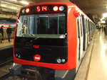
Avinguda Diagonal

Avinguda Diagonal (Catalan pronunciation: [əβiŋˈɡuðə ði.əɣuˈnal], in Spanish Avenida Diagonal) is the name of one of Barcelona's broadest and most important avenues. It cuts the city in two, diagonally with respect to the grid pattern of the surrounding streets, hence the name. It was originally projected by engineer and urban planner Ildefons Cerdà as one of the city's wide avenues, which along with Avinguda Meridiana would cut the rationalist grid he designed for l'Eixample (Catalan for extension). Both would meet at Plaça de les Glòries Catalanes, which Cerdà envisioned as the new city centre. However, Plaça Catalunya, equally a new addition to the city of Barcelona, and connecting Ciutat Vella and Eixample, and therefore occupying a more privileged position in the urban area, would finally become the centre. Avinguda Diagonal remains to this day a much-transited avenue and many companies and hotels use it as a privileged location, as can be seen in its architecture. The avenue starts in the Les Corts district on the western edge of the city and runs to the Sant Martí district on the eastern edge. To its west, it connects with the Lleida-Madrid highway and Ronda de Dalt in the neighbouring municipality of Esplugues de Llobregat. To its east, it meets the Ronda del Litoral on the border with the municipality of Sant Adrià de Besòs. It is consistently 50 metres (160 ft) wide and about 11 kilometres (6.8 mi) long.
Excerpt from the Wikipedia article Avinguda Diagonal (License: CC BY-SA 3.0, Authors, Images).Avinguda Diagonal
Carrer de la Riera de Sant Miquel, Barcelona
Geographical coordinates (GPS) Address Nearby Places Show on map
Geographical coordinates (GPS)
| Latitude | Longitude |
|---|---|
| N 41.396388888889 ° | E 2.1580555555556 ° |
Address
Església i convent de Pompeia
Carrer de la Riera de Sant Miquel
08001 Barcelona (Gràcia)
Catalonia, Spain
Open on Google Maps


