Longlands
Areas of LondonDistricts of the London Borough of BexleyDistricts of the London Borough of BromleyDistricts of the Royal Borough of GreenwichSidcup ... and 1 more
Use British English from September 2015

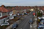
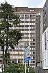
Longlands is an area of South East London overlapping the London Boroughs of Bexley, Bromley and Greenwich. It lies north west of Sidcup and south east of Eltham. Some old maps and records have the name as two words "Long Lands", and show it was in the Foots Cray/Sidcup parish in the Hundred of Ruxley.
Excerpt from the Wikipedia article Longlands (License: CC BY-SA 3.0, Authors, Images).Longlands
Main Road, London Longlands
Geographical coordinates (GPS) Address Nearby Places Show on map
Geographical coordinates (GPS)
| Latitude | Longitude |
|---|---|
| N 51.4302 ° | E 0.0854 ° |
Address
Main Road 276
DA14 6QE London, Longlands
England, United Kingdom
Open on Google Maps


