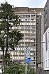
Sidcup
Areas of LondonDistricts of the London Borough of BexleySidcupUse British English from September 2015

Sidcup is an area of south-east London, England, primarily in the London Borough of Bexley. It is 11.3 miles (18.2 km) south-east of Charing Cross, bordering the London Boroughs of Bromley and Greenwich, and is in the historic county of Kent. The name is thought to be derived from Cetecopp meaning "seat shaped or flat topped hill"; it had its earliest recorded use in 1254. The population of Sidcup, including its neighbourhoods Foots Cray, North Cray, Albany Park, Longlands, Ruxley, Blackfen and Lamorbey, was 43,109 in 2011.
Excerpt from the Wikipedia article Sidcup (License: CC BY-SA 3.0, Authors, Images).Sidcup
High Street, London Longlands (London Borough of Bexley)
Geographical coordinates (GPS) Address Nearby Places Show on map
Geographical coordinates (GPS)
| Latitude | Longitude |
|---|---|
| N 51.4263 ° | E 0.1024 ° |
Address
Safeguarding Plus
High Street
DA14 6DW London, Longlands (London Borough of Bexley)
England, United Kingdom
Open on Google Maps


