Lindford, Hampshire
Hampshire geography stubsVillages in Hampshire
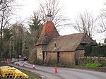
Lindford is a village and civil parish in the East Hampshire district of Hampshire, England. It is approximately 1 mile (1.6 km) northeast of Bordon, and west of Headley, East Hampshire on the B3004 road. The nearest railway station is Liphook, 4 miles (6.4 km) southeast of the village. With a population of around 2,700, Lindford has a village shop, post office, private dental practice, hair dresser, as well as a Methodist church, a village hall, a pub, The Royal Exchange, and a club.
Excerpt from the Wikipedia article Lindford, Hampshire (License: CC BY-SA 3.0, Authors).Lindford, Hampshire
Liphook Road, East Hampshire Lindford
Geographical coordinates (GPS) Address Nearby Places Show on map
Geographical coordinates (GPS)
| Latitude | Longitude |
|---|---|
| N 51.11803 ° | E -0.84489 ° |
Address
Liphook Road
GU35 0PW East Hampshire, Lindford
England, United Kingdom
Open on Google Maps


