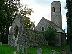
Dunston, Norfolk
Former civil parishes in NorfolkNorfolk geography stubsSouth NorfolkVillages in Norfolk

Dunston is a village in the civil parish of Stoke Holy Cross, in the South Norfolk district, in the county of Norfolk, England. It is located in the valley of the River Tas between Stoke Holy Cross and Caistor St. Edmund, approximately 3 miles south of Norwich. It has a common which is popular with walkers. In 1931 the parish had a population of 63. On 1 April 1935 the civil parish was abolished and merged with Stoke Holy Cross.The villages name means 'Dun(n)(i)'s farm/settlement'.Parish records for Dunston exist as far back as 1557.Dunston Hall is now a hotel.
Excerpt from the Wikipedia article Dunston, Norfolk (License: CC BY-SA 3.0, Authors, Images).Dunston, Norfolk
Stoke Road, South Norfolk Stoke Holy Cross
Geographical coordinates (GPS) Address Nearby Places Show on map
Geographical coordinates (GPS)
| Latitude | Longitude |
|---|---|
| N 52.5767 ° | E 1.2839 ° |
Address
Stoke Road
NR14 8PE South Norfolk, Stoke Holy Cross
England, United Kingdom
Open on Google Maps


