Keswick, South Norfolk

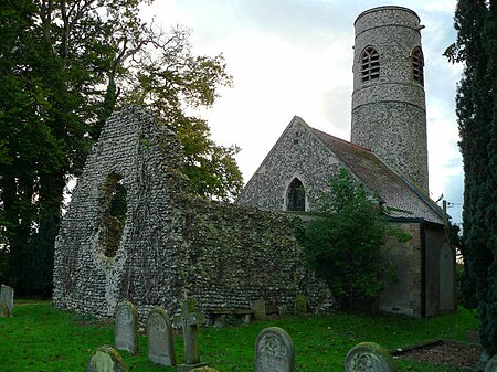
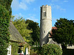
Keswick is a village in the civil parish of Keswick and Intwood, in Norfolk, England. It is situated some 3 miles (4.8 km) to the south of the city of Norwich. It should not be mistaken for the coastal settlement of Keswick, near Bacton, which is also in Norfolk.[1]The civil parish has an area of 5.52 km2 (2.13 sq mi) and in the 2001 census had a population of 431 in 248 households, the population increasing to 444 at the 2011 census. For the purposes of local government, the parish falls within the district of South Norfolk.[2]The church of Keswick All Saints is one of 124 existing round-tower churches in Norfolk. There was a small early church here, but it was demolished c 1598 to use the materials to repair Intwood’s round-tower church, when the two parishes were consolidated. The original east wall of the chancel still stands to the east of the existing church, and part of the tower could also be Saxon, although it was much repaired in 1893. At that time the short nave was added to the tower to make a mortuary chapel. In 1934 church services were authorised, but the apse was not added until some decades later.Keswick Hall near All Saints was the representative manor and country house that served as a residence of the Gurney family. Between 1948 and 1981 it accommodated a teacher training college (which was then incorporated into the University of East Anglia) prior to being converted into apartments. Several members of the Gurneys of Keswick are buried in the churchyard of All Saints.Former professional footballer Darren Huckerby lives in the village.
Excerpt from the Wikipedia article Keswick, South Norfolk (License: CC BY-SA 3.0, Authors, Images).Keswick, South Norfolk
Main Road, South Norfolk Keswick and Intwood
Geographical coordinates (GPS) Address Nearby Places Show on map
Geographical coordinates (GPS)
| Latitude | Longitude |
|---|---|
| N 52.593 ° | E 1.266 ° |
Address
Main Road
Main Road
NR4 6TY South Norfolk, Keswick and Intwood
England, United Kingdom
Open on Google Maps


