place

Portland Transportation Center

2001 establishments in MaineAmtrak stations in MaineBus stations in MaineFormer Boston and Maine Railroad stationsMaine building and structure stubs
Maine transportation stubsNortheastern United States railway station stubsRailway stations in the United States opened in 2001Transit centers in the United StatesTransportation buildings and structures in Portland, MaineUse mdy dates from April 2022
Downeaster at Portland Transportation Center, May 2010

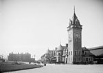
Portland Transportation Center is a bus and train station in Portland, Maine, United States, served and run primarily by Concord Coach Lines (18 round-trips a day) and Amtrak Downeaster passenger trains (five round-trips a day). It is also served by Megabus (via Concord Coach Lines), as well as the Greater Portland Metro route 1 and BREEZ bus services. The station is open from 4:30 AM to 12:15 AM and from 2:45 AM to 3:15 AM.Portland Transportation Center is located in Portland's Libbytown neighborhood, about a half mile west of the former site of Portland Union Station. It is located next to Pan Am Railways' Mountain Branch, formerly the Mountain Division of the Maine Central Railroad. In 2019, the NNERPA Board (which governs the Downeaster service) supported a proposal to relocate the station to the mainline to avoid time-consuming backup moves. A two-year study by the Maine Department of Transportation endorsed moving Amtrak service from this station to a location near that of Portland's original Union Station, on St. John's Street.

Excerpt from the Wikipedia article Portland Transportation Center (License: CC BY-SA 3.0, Authors, Images).

Portland Transportation Center
Thompsons Point Road, Portland

Geographical coordinates (GPS) Address Nearby Places
placeShow on map

Wikipedia: Portland Transportation CenterContinue reading on Wikipedia

Geographical coordinates (GPS)

Latitude Longitude
N 43.653611111111 ° E -70.291111111111 °
placeShow on map

Address

Thompsons Point Road
04102 Portland
Maine, United States
mapOpen on Google Maps

Downeaster at Portland Transportation Center, May 2010
Share experience

Nearby Places

St. John Street (Portland, Maine)

St. John Street is a street in Portland, Maine, United States. It runs for around 1.34 miles (2.16 km) from Brighton Avenue (part of Maine State Route 25), in the north, to Valley Street, in the south. It crosses Park Avenue (part of Maine State Route 22) and Congress Street and passes beneath Interstate 295. Both St. John Street and adjacent Valley Street were built upon land occupied by Portland's poor farm. St. John Street is named for St. John Smith (1876–1944), a landowner friend and business partner of industrialist John Bundy Brown. The city's Union Station stood in Railroad Square on St. John Street between 1888 and 1961, when it was demolished and replaced with today's Union Station Plaza strip mall. Beside that location, to the south, is the Maine Central Railroad General Office Building, which was completed in 1916. It is listed on the National Register of Historic Places. A spur of the Portland and Ogdensburg Railway from Union Station crosses Maine Central Railroad's trestle bridge at St. John Street and Park Avenue. The line continues behind Hadlock Field and Fitzpatrick Stadium before ending at Forest Avenue, beside Deering Oaks Park. The Inn at St. John (formerly the Hotel Victoria), which stands at the intersection of St. John Street and Congress Street, has been in operation since 1897. Its location was chosen because of its proximity to Union Station. St. John Street was the home to Portland's first McDonald's. It is still in operation. Portland's Greyhound bus station was formerly located at the intersection of St. John Street and Congress Street. The building, constructed in 1961, closed in 2019, after 32 years of ownership by Greyhound. Buses now depart from the park and ride lot on Marginal Way.