place

Koʻolau Range

Cenozoic HawaiiExtinct volcanoes of the United StatesMountains of HawaiiNational Natural Landmarks in HawaiiNeogene Oceania
Pleistocene OceaniaPleistocene shield volcanoesPliocene shield volcanoesPolygenetic shield volcanoesVolcanoes of Oahu
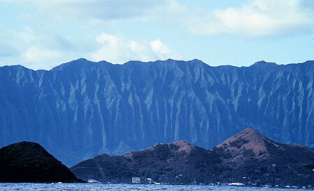
Koolau Range
Koolau Range

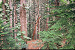
Koʻolau Range is a name given to the dormant fragmented remnant of the eastern or windward shield volcano of the Hawaiian island of Oʻahu. It was designated a National Natural Landmark in 1972.

Excerpt from the Wikipedia article Koʻolau Range (License: CC BY-SA 3.0, Authors, Images).

Koʻolau Range
Manana Ridge Trail, Pearl City

Geographical coordinates (GPS) Address Nearby Places
placeShow on map

Wikipedia: Koʻolau RangeContinue reading on Wikipedia

Geographical coordinates (GPS)

Latitude Longitude
N 21.45 ° E -157.9 °
placeShow on map

Address

Manana Ridge Trail

Manana Ridge Trail
96701 Pearl City
Hawaii, United States
mapOpen on Google Maps

Koolau Range
Koolau Range
Share experience

Nearby Places

Keaīwa Heiau State Recreation Area

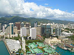
Keaīwa Heiau State Recreation Area is the ruins of a temple (Heiau in the Hawaiian language) at the summit of a hill and neighborhood called ʻAiea Heights on Oʻahu, Hawaiʻi. The recreation area includes camping facilities and a 4.8-mile (7.7 km) trail. It also offers clear views of Pearl Harbor. The high point of Puu Uau is about halfway down the trail, where native ohia lehua and koa trees may be viewed. The remains of a military plane that crashed in 1944 can also be seen along the trail. The hike is not particularly difficult, however it does include one quite steep switchback stretch and can be extremely muddy if it has just rained. Allow for around 2.5 hours of easy strolling. A possible translation of Keaʻiwa would be mysterious, incomprehensible. It is believed that this name was given in reference to the healing powers of the plants that no one could really explain. In addition, Keaiwa Heiau may have also been known as a "Heiau Hoʻola," or the healing or life-giving heiau according to native Hawaiian scholar Mary Kawena Pukui.Foresters replanted most of this area in the late 1920s. The lemon eucalyptus trees give forth a mild citrus scent in the air. The trail's lower end is marked by stands of Norfolk Island pine trees. Pu'u Uau, the trail's high point around halfway along the length, is surrounded by native koa and ohi'a trees. There is also wreckage of a B-24 aircraft that went down in 1944. The name "Keʻaiwa" means "strange" or "incomprehensible" in Hawaiian. Perhaps the name refers to the idea that the powers of the kahuna and the plants employed in healing are unfathomable.Erected sometime in the 16th century by Kakuhihewa, the 15th Aliʻi ʻAimoku, or ruling chief, of Oahu, the 100 feet (24 m) by 160 feet (49 m) stone temple had walls averaging 4 ft in height and 5 ft in width. The walls consisted of numerous evenly faced one foot stones that are filled with rubble. Abundant medicinal herbs in the area were used by kahuna as a type of ancient herbal clinic. The kahuna would also train haumana (students) interested in the art of laʻau lapaʻau (healing medicine). The kahuna would also train students in the practice of praying, fasting, and medicinal healing using the neighboring plants. The reputed healing powers of the surrounding plants still draws visitors who leave temple offerings, hoping to experience medicinal benefits.Most of the trees in the area were replanted during the early 20th century. Although native species can be found at the highpoint of the trail. The remnants of a military airplane that crashed onto the area in 1993 can also be seen from the trail.The site provides a map for the 4.5 miles (7.2 km) Aiea Loop Trail. Several varieties of trees and other vegetation are enjoyed by visitors who make the trek.

Kahaluʻu Taro Loʻi
Kahaluʻu Taro Loʻi

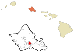
The Kahaluʻu Taro Loʻi Historic District, also known as the ʻĀhuimanu Taro Complex, in Kahaluʻu on the windward side of Oʻahu, is the most complex and largest intact system of terraces for growing wetland taro on Oʻahu. It contains at least 18 loʻi (pondfield) terraces once watered by ʻĀhuimanu Stream and associated ʻauwai (irrigation ditches) over about 25 acres (100,000 m2) that start from headwaters just below the cliffs of the Koʻolau Range. It was added to the National Register of Historic Places in 1973, after windward residents raised concerns about development plans in the area. The Kahaluu Fish Pond was also added to the National Register at that time. The terraces are roughly rectangular in shape and average 5 by 10 meters in size, with front facings of stacked stone ranging up to 2 meters or more in height. The pondfields have all been silted in and are often obscured by heavy overgrowth of hau, mango, and guava trees, but they have withstood many generations of heavy rainfall on steeply sloping hillsides, in silent testimony to ancient Hawaiian expertise in irrigation and flood control. In 1973, a University of Hawaiʻi archaeology program field school excavated soil profiles from the terraces, and the site was cleared during the 1980s, but the State of Hawaiʻi Historic Preservation Division is now seeking community organizations willing to clear the site and make it operational again.The site is owned by Temple Valley Corp., which has continued to develop new houses around it. At the time of the NRHP nomination, the Historic District was said to lie 900 meters west of the west end of Hui Kelu Street and to be accessible via an abandoned jeep road. Even as late as July 1996, a hiker described returning via the jeep road. But Hui Kelu Street has since been extended across ʻĀhuimanu Stream, where the hiking trail begins, and the lower portion of the jeep road is now Heno Place.

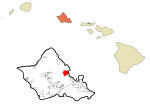
North Koolaupoko, Hawaii

Waikāne or Waikane (Hawaiian pronunciation: [vɐjˈkaːne]), also known as North Koʻolaupoko ([-koʔolɐwˈpoko]), is an area and census-designated place in the County of Honolulu, Hawaii, United States, on the island of Oʻahu. It had a population of 778 at the 2010 census. In Hawaiian, koʻolau poko means "short windward", referring to the fact that this is the shorter of the two windward districts on the island (Koʻolauloa or "long windward" is the other). Koʻolaupoko extends from Makapuʻu Point on the southeast to Kaʻōʻio Point on the north. Included within the district, south of North Koʻolaupoko, are the largest windward towns of Kāneʻohe, Kailua, and Waimānalo. Waikāne lies mostly along the coastline of Kāneʻohe Bay and consists of several lush valleys that extend inland to the steep face of the Koʻolau pali (cliff). The first valley north of Kahaluʻu is Waiāhole. Next is Waikāne, then Hakipuʻu, and northernmost is Kualoa. This area differs from the towns, valleys, and ahupuaʻa of the southern part of Koʻolaupoko in that it is mostly undeveloped, decidedly rural in character, with many small farms. Despite the long shoreline, public access to Kāneʻohe Bay is somewhat limited by private holdings. A small community park at Waiāhole was enlarged and improved in 2003. A larger city and county park at Kualoa provides camping and picnic areas, a long narrow beach, and views of Mokoliʻi Islet. The south side of Kualoa Regional Park faces onto Kāneʻohe Bay, and the east shore is a fringing reef off the Pacific Ocean coast of northeast Oʻahu. The U.S. postal code for all of North Koʻolaupoko is 96744 (the same as Kāneʻohe).